
Atacama Desert: Difference between revisions
typo |
→Setting: ~~ my best guess on what was intended |
||
| (348 intermediate revisions by more than 100 users not shown) | |||
| Line 1: | Line 1: | ||
{{short description|Desert in South America}} |
|||
{{redirect|Atacama}} |
{{redirect|Atacama}} |
||
{{short description|desert in South America}} |
|||
{{Use dmy dates|date=February 2019}} |
{{Use dmy dates|date=February 2019}} |
||
{{Infobox |
{{Infobox ecoregion |
||
| |
|name = Atacama Desert |
||
|image = Atacama.png |
|||
| other_name = |
|||
|image_size =250 |
|||
| photo = Atacama.png |
|||
|image_alt = |
|||
| photo_caption =Atacama by [[NASA World Wind]] |
|||
|caption = Atacama by [[NASA World Wind]] |
|||
<!-- MAP --> |
|||
| |
|map = Atacama map.svg |
||
|map_size = 250 |
|||
| map_image = Atacama map.svg |
|||
|map_alt = |
|||
| map_caption = Map of the Atacama Desert: The area most commonly defined as Atacama is yellow. In orange are the outlying arid areas of the southern [[Chala]], [[Altiplano]], [[Puna de Atacama]], and [[Norte Chico, Chile|Norte Chico]]. |
|||
|map_caption = Map of the Atacama Desert: the area most commonly defined as Atacama is in yellow. In orange are the outlying arid areas of the southern [[Chala]], [[Altiplano]], [[Puna de Atacama]], and [[Norte Chico, Chile|Norte Chico]]. |
|||
<!-- Location --> |
|||
|biogeographic_realm = [[Neotropical realm|Neotropical]] |
|||
| location = |
|||
|biome = [[Deserts and xeric shrublands]] |
|||
| country = [[Chile]] |
|||
|border = [[Central Andean dry puna]] |
|||
| region = |
|||
|border1 = [[Chilean matorral]], |
|||
| state = |
|||
|border2 = [[Sechura Desert]] |
|||
| district = |
|||
|animals = |
|||
| city = |
|||
|bird_species = |
|||
| relief = |
|||
|mammal_species = |
|||
| label = |
|||
|area = 104,741 |
|||
| label_position = |
|||
|country = [[Chile]] |
|||
| coordinates = {{Coord|24|30|S|69|15|W|scale:5000000|display=title, inline}} |
|||
|elevation = |
|||
| coordinates_ref = |
|||
|coordinates = {{Coord|24|30|S|69|15|W|scale:5000000|display=title, inline}} |
|||
<!-- Statistics --> |
|||
|geology = |
|||
| elevation = |
|||
|rivers = |
|||
| elevation_m = |
|||
|climate = |
|||
| elevation_ft = |
|||
|soil = |
|||
| elevation_ref = |
|||
|conservation = |
|||
| length = |
|||
|global200 = |
|||
| length_mi = |
|||
|habitat_loss = |
|||
| length_km = |
|||
|habitat_loss_ref = |
|||
| length_orientation = |
|||
|protected = 3,385 km² (3 |
|||
| length_note = |
|||
|protected_ref = )<ref name =Dinerstein>Eric Dinerstein, David Olson, et al. (2017). An Ecoregion-Based Approach to Protecting Half the Terrestrial Realm, BioScience, Volume 67, Issue 6, June 2017, Pages 534–545; Supplemental material 2 table S1b. [https://doi.org/10.1093/biosci/bix014]</ref> |
|||
| width = |
|||
|embedded = |
|||
| width_mi = |
|||
| width_km = |
|||
| width_orientation = |
|||
| width_note = |
|||
| area = |
|||
| area_mi2 = |
|||
| area_km2 = 105000 |
|||
| depth = |
|||
| depth_ft = |
|||
| depth_m = |
|||
| type = |
|||
| age = |
|||
| border = |
|||
| topo = |
|||
| traversed = |
|||
| river = |
|||
<!-- Below --> |
|||
| footnotes = |
|||
| embed = |
|||
}} |
}} |
||
The '''Atacama Desert''' ({{lang-es|Desierto de Atacama}}) is a desert [[plateau]] in [[South America]] covering a 1,000-km (600-mi) strip of land on the [[Pacific Ocean|Pacific]] coast, west of the [[Andes]] mountains. The Atacama desert is one of the driest places in the world (the driest being some very specific spots within the [[McMurdo Dry Valleys]]<ref>{{cite journal |last= Clow, G. D., McKay, C. P., Simmons Jr, G. M., & Wharton Jr, R. A. |title=Climatological observations and predicted sublimation rates at Lake Hoare, Antarctica |date=1988 |journal=Journal of Climate |volume=1 |issue=7 |pages=715–728|doi=10.1175/1520-0442(1988)001<0715:COAPSR>2.0.CO;2 }}</ref><ref>{{cite journal |last= Doran, P. T., McKay, C. P., Clow, G. D., Dana, G. L., Fountain, A. G., Nylen, T., & Lyons, W. B. |title=Valley floor climate observations from the McMurdo Dry Valleys |date=2002 |journal=Journal of Geophysical Research: Atmospheres |volume=107(D24) |pages=ACL–13 }}</ref><ref>{{cite journal |last= Porazinska, D. L., Fountain, A. G., Nylen, T. H., Tranter, M., Virginia, R. A., & Wall, D. H. |title=VThe biodiversity and biogeochemistry of cryoconite holes from McMurdo Dry Valley glaciers, Antarctica |date=2004 |journal=Antarctica. Arctic, Antarctic, and Alpine Research |volume=36 |issue=1 |pages=84–91 |doi=10.1657/1523-0430(2004)036[0084:TBABOC]2.0.CO;2 |url=https://pdxscholar.library.pdx.edu/geog_fac/12 }}</ref><ref>{{cite web |url=https://ourplnt.com/top-ten-driest-places-earth/ |title =Top 10 driest places on Earth |author=Our Planet |date =9 November 2015 }}</ref>), as well as the only [[Desert climate|true desert]] to receive less precipitation than the [[polar desert]]s. According to estimates, the Atacama Desert occupies {{convert|105000|km2|mi2|-3|abbr=on}},<ref name=nyt>{{cite book|editor-first=John W. |editor-last=Wright|year=2006 |title=The New York Times Almanac |edition=2007 |publisher=Penguin Books |location=New York |isbn=978-0-14-303820-7 |pages=456}}</ref> or {{convert|128000|km2|mi2|-3|abbr=on}} if the barren lower slopes of the Andes are included.<ref name=PGarid>{{Cite book |
|||
| last1 = Rundel |
|||
| first1 = P. W. |
|||
| last2 = Villagra |
|||
| first2 = P. E. |
|||
| last3 = Dillon |
|||
| first3 = M. O. |
|||
| last4 = Roig-Juñent |
|||
| first4 = S. |
|||
| last5 = Debandi |
|||
| first5 = G. |
|||
| display-authors = 2 |
|||
|editor-first1=Thomas T. |
|||
|editor-last1=Veblen |
|||
|editor-first2=Kenneth R. |
|||
|editor-last2=Young |
|||
|editor-first3=Anthony R. |
|||
|editor-last3=Orme |
|||
|editor-link1=Thomas T. Veblen |
|||
|chapter=Arid and Semi-Arid Ecosystems |
|||
| title = Physical Geography of South America |
|||
| issue = |
|||
| pages = 158–183 |
|||
| year = 2007 |
|||
|publisher=Oxford University Press |
|||
}}</ref> Most of the desert is composed of stony terrain, [[Salt lake (geography)|salt lakes]] (''salares''), [[sand]], and [[felsic lava]] that flows towards the Andes. |
|||
The '''Atacama Desert''' ({{lang-es|Desierto de Atacama}}) is a desert [[plateau]] located on the [[Pacific Ocean|Pacific]] coast of [[South America]], in the north of [[Chile]]. Stretching over a 1,600 km (990 mi) strip of land west of the [[Andes Mountains]], it covers an area of {{convert|105000|km2|mi2|-3|abbr=on}},<ref name="nyt">{{cite book |url=https://archive.org/details/newyorktimes200600wrig |title=The New York Times Almanac |publisher=Penguin Books |year=2006 |isbn=978-0-14-303820-7 |editor-last=Wright |editor-first=John W. |edition=2007 |location=New York |pages=[https://archive.org/details/newyorktimes200600wrig/page/456 456] |url-access=registration}}</ref> which increases to {{convert|128000|km2|mi2|-3|abbr=on}} if the barren lower slopes of the Andes are included.<ref name="PGarid">{{cite book |last1=Rundel |first1=P.W. |title=Physical Geography of South America |last2=Villagra |first2=P.E. |last3=Dillon |first3=M.O. |last4=Roig-Juñent |first4=S. |last5=Debandi |first5=G. |publisher=[[Oxford University Press]] |year=2007 |editor1-last=Veblen |editor1-first=Thomas T. |editor1-link=Thomas T. Veblen |pages=158–183 |chapter=Arid and Semi-Arid Ecosystems |display-authors=2 |editor2-last=Young |editor2-first=Kenneth R. |editor3-last=Orme |editor3-first=Anthony R.}}</ref> |
|||
The desert owes its extreme aridity to a constant [[Inversion_(meteorology)|temperature inversion]] due to the cool north-flowing [[Humboldt current|Humboldt ocean current]], and to the presence of the strong [[South Pacific High|Pacific anticyclone]].<ref>{{cite journal |last=Mckay|first=Christopher P. |title=Temperature and Moisture Conditions for Life in the Extreme Arid Region of the Atacama Desert: Four Years of Observations Including the El Niño of 1997–1998|date=2003|journal=Astrobiology|url=http://ifa.hawaii.edu/~meech/a281/handouts/mckay03.pdf|volume=3|number=2|pages=393–406|bibcode=2003AsBio...3..393M|doi=10.1089/153110703769016460|pmid=14577886 |citeseerx=10.1.1.516.2293 }}</ref> The most arid region of the Atacama desert is situated between two mountain chains (the [[Andes]] and the [[Chilean Coast Range]]) of sufficient height to prevent moisture [[advection]] from either the Pacific or the Atlantic Oceans, a two-sided [[rain shadow]].<ref name=PhysGeogSA>{{cite book|title=The Physical Geography of South America |year=2007 |publisher=Oxford University Press |isbn=978-0-19-531341-3 |page=160 |editor=Veblen, Thomas T.|editor-link=Thomas T. Veblen}}</ref> |
|||
The Atacama Desert is the driest nonpolar desert in the world, and the second driest overall, behind some specific spots within the [[McMurdo Dry Valleys]].<ref>{{cite journal |vauthors=Clow GD, McKay CP, Simmons Jr GM, Wharton Jr RA |title=Climatological observations and predicted sublimation rates at Lake Hoare, Antarctica |date=1988 |journal=Journal of Climate |volume=1 |issue=7 |pages=715–728 |pmid=11538066 |bibcode=1988JCli....1..715C |doi=10.1175/1520-0442(1988)001<0715:COAPSR>2.0.CO;2 |doi-access=free}}</ref><ref>{{cite journal |vauthors=Doran PT, McKay CP, Clow GD, Dana GL, Fountain AG, Nylen T, Lyons WB |title=Valley floor climate observations from the McMurdo Dry Valleys |journal=Journal of Geophysical Research: Atmospheres |volume=107 |issue=D24 |pages=ACL–13 |date=2002}}</ref><ref>{{cite journal |vauthors=Porazinska DL, Fountain AG, Nylen TH, Tranter M, Virginia RA, Wall DH |title=The biodiversity and biogeochemistry of cryoconite holes from McMurdo Dry Valley glaciers, Antarctica |url=https://pdxscholar.library.pdx.edu/geog_fac/12 |journal=Arctic, Antarctic, and Alpine Research |volume=36 |issue=1 |pages=84–91 |date=2004 |doi=10.1657/1523-0430(2004)036[0084:TBABOC]2.0.CO;2 |s2cid=35782175 |issn=1523-0430}}</ref><ref>{{cite web |website=Our Planet |title=Top 10 driest places on Earth |date=9 November 2015 |url=https://ourplnt.com/top-ten-driest-places-earth/}}</ref> It is the only hot [[Desert climate|true desert]] to receive less precipitation than [[polar desert]]s, and the largest [[fog desert]] in the world. The area has been used as an experimentation site for [[Mars]] expedition simulations due to its similarities to the Martian environment. |
|||
The constant [[Inversion (meteorology)|temperature inversion]] caused by the cool north-flowing [[Humboldt Current|Humboldt]] [[Ocean current]] and the strong [[South Pacific High|Pacific anticyclone]] contribute to the extreme aridity of the desert.<ref>{{cite journal |last=Mckay |first=Christopher P. |title=Temperature and Moisture Conditions for Life in the Extreme Arid Region of the Atacama Desert: Four Years of Observations Including the El Niño of 1997–1998 |journal=Astrobiology |volume=3 |number=2 |pages=393–406 |date=2003 |bibcode=2003AsBio...3..393M |pmid=14577886 |citeseerx=10.1.1.516.2293 |url=http://ifa.hawaii.edu/~meech/a281/handouts/mckay03.pdf |doi=10.1089/153110703769016460}}</ref> The most arid region of the Atacama Desert is situated between two mountain chains, the Andes and the [[Chilean Coast Range]], which are high enough to prevent moisture [[advection]] from either the Pacific or the Atlantic Ocean, creating a two-sided [[rain shadow]] effect.<ref name="PhysGeogSA">{{cite book |editor=Veblen, Thomas T.|editor-link=Thomas T. Veblen |title=The Physical Geography of South America |publisher=Oxford University Press |year=2007 |page=160 |isbn=978-0-19-531341-3}}</ref> |
|||
== Setting == |
== Setting == |
||
{{see also|Andean orogeny|Arid Diagonal}} |
{{see also|Andean orogeny|Arid Diagonal}} |
||
According to the [[World Wide Fund for Nature]], the Atacama Desert [[ecoregion]] occupies a continuous strip for nearly 1,600 km along the narrow coast of the northern third of [[Chile]], from near [[Arica]] (18° |
According to the [[World Wide Fund for Nature]], the Atacama Desert [[ecoregion]] occupies a continuous strip for nearly 1,600 km (1,000 mi) along the narrow coast of the northern third of [[Chile]], from near [[Arica]] (18°24′S) southward to near [[La Serena, Chile|La Serena]] (29°55′S).<ref>{{WWF ecoregion|name=Atacama desert|id=nt1303|access-date=11 March 2008}}</ref> The [[National Geographic Society]] considers the coastal area of southern [[Peru]] to be part of the Atacama Desert<ref name=NatGeo_Viking>{{cite web|last=Handwerk|first=Brian|title=Viking Mission May Have Missed Mars Life, Study Finds|url=http://news.nationalgeographic.com/news/2006/10/061023-mars-life.html|archive-url=https://web.archive.org/web/20061106191148/http://news.nationalgeographic.com/news/2006/10/061023-mars-life.html|url-status=dead|archive-date=6 November 2006|work=National Geographic News|publisher=National Geographic Society|access-date=3 April 2013|date=23 October 2006}}</ref><ref name=NatGeo_GiantPenguin>{{cite web|last=Minard|first=Anne|title=Giant Penguins Once Roamed Peru, Fossils Show|url=http://news.nationalgeographic.com/news/2007/06/070625-giant-penguins.html|archive-url=https://web.archive.org/web/20070628185533/http://news.nationalgeographic.com/news/2007/06/070625-giant-penguins.html|url-status=dead|archive-date=28 June 2007|work=National Geographic News|publisher=National Geographic Society|access-date=3 April 2013|date=25 June 2007}}</ref> and includes the deserts south of the [[Ica Region]] in Peru. However, other sources consider that the part of the desert in Peru is a different ecosystem, and should properly be named as Pampas de la Joya desert. |
||
Peru borders it on the north and the [[Chilean Matorral]] ecoregion borders it on the south. To the east lies the less arid [[Central Andean dry puna]] ecoregion. The drier portion of this ecoregion is located south of the [[Loa River]] between the parallel [[Sierra Vicuña Mackenna]] and [[Cordillera Domeyko]]. To the north of the Loa lies the [[Pampa del Tamarugal]]. |
Peru borders it on the north and the [[Chilean Matorral]] ecoregion borders it on the south. To the east lies the less arid [[Central Andean dry puna|Central Andean dry Puna]] ecoregion. The drier portion of this ecoregion is located south of the [[Loa River]] between the parallel [[Sierra Vicuña Mackenna]] and the [[Cordillera Domeyko]]. To the north of the Loa lies the [[Pampa del Tamarugal]]. |
||
The [[Coastal Cliff of northern Chile]] west of the [[Chilean Coast Range]] is the main topographical feature of the coast.<ref>{{cite journal | |
The [[Coastal Cliff of northern Chile]] west of the [[Chilean Coast Range]] is the main topographical feature of the coast.<ref>{{cite journal |last1=Quezada |first1=Jorge |last2=Cerda |first2=José Luis |last3=Jensen |first3=Arturo |date=2010 |title=Efectos de la tectónica y el clima en la configuración morfológica del relieve costero del norte de Chile |language=es |journal=[[Andean Geology]] |volume=37 |issue=1 |pages=78–109 |doi= 10.4067/s0718-71062010000100004|doi-access=free }}</ref> The geomorphology of the Atacama Desert has been characterized as a low-relief bench "similar to a giant uplifted terrace" by Armijo and co-workers.<ref name=Armijoetal2015>{{cite journal |last1=Armijo |first1=Rolando |last2=Lacassin |first2=Robin |last3=Coudurier-Curveur |first3=Aurélie |last4=Carrizo |first4=Daniel |title=Coupled tectonic evolution of Andean orogeny and global climate |journal=Earth-Science Reviews |volume=143 |pages=1–35 |date=2015 |bibcode=2015ESRv..143....1A |doi=10.1016/j.earscirev.2015.01.005 |doi-access=free}}</ref> The intermediate depression (or Central Valley) forms a series of [[endorheic basin]]s in much of the Atacama Desert south of latitude 19°30'S. North of this latitude, the intermediate depression drains into the Pacific Ocean.<ref name=Evenstaretal2014>{{cite journal |last1=Evenstar |first1=Laura |last2=Mather |first2=Anna |last3=Stuart |first3=Finlay |last4=Cooper |first4=Frances|last5=Sparks|first5=Steve |date=May 2014 |title=Geomorphic surfaces and supergene enrichment in Northern Chile |journal=EGU General Assembly Conference Abstracts |pages=11126 |publisher=EGU General Assembly 2014, held 27 April - 2 May 2014 |location=Vienna |bibcode=2014EGUGA..1611126E}}</ref> |
||
The intermediate depression (or Central Valley) forms a series of [[endorheic basin]]s in much of Atacama Desert south of latitude 19°30'S. North of this latitude, the intermediate depression drains into the Pacific Ocean.<ref name=Evenstaretal2014>{{cite journal |last1=Evenstar |first1=Laura |last2=Mather |first2=Anna |last3=Stuart |first3=Finlay |last4=Cooper |first4=Frances|last5=Sparks|first5=Steve |date=May 2014 |title=Geomorphic surfaces and supergene enrichment in Northern Chile |publisher=EGU General Assembly 2014, held 27 April - 2 May 2014 |location=Vienna }}</ref> |
|||
In December 2023, scientists, for the first time, reported on a recently discovered area in the territory of [[Puna de Atacama]], which may have similarities to Earth during the [[Archean Eon|Archean]] eon and thus to the environment of the [[Earliest known life forms|first life forms on Earth]]. It could as well be similar to conceivably-hospitable conditions on the planet [[Mars]] during earlier Martian times.<ref name="CU-20231206">{{cite news |last=Strain |first=Daniel |title=Deep within an inhospitable desert, a window to the first life on Earth |url=https://www.colorado.edu/today/2023/12/06/deep-within-inhospitable-desert-window-first-life-earth |date=6 December 2023 |work=[[University of Colorado]] |url-status=live |archiveurl=https://archive.today/20231230225404/https://www.colorado.edu/today/2023/12/06/deep-within-inhospitable-desert-window-first-life-earth |archivedate=30 December 2023 |accessdate=30 December 2023 }}</ref> |
|||
==Climate== |
==Climate== |
||
[[File:Snow Comes to the Atacama Desert.jpg|thumb|Snow in [[Paranal Observatory]] at 2,600 [[m.a.s.l.|masl]]<ref>{{cite news|title=Snow Comes to the Atacama Desert|url=http://www.eso.org/public/images/potw1309a/| |
[[File:Snow Comes to the Atacama Desert.jpg|thumb|upright=1.2|Snow in [[Paranal Observatory]] at 2,600 [[m.a.s.l.|masl]]<ref>{{cite news|title=Snow Comes to the Atacama Desert|url=http://www.eso.org/public/images/potw1309a/|access-date=3 April 2013|publisher=ESO}}</ref>]] |
||
The almost total lack of precipitation is the most prominent characteristic of the Atacama Desert.<ref>{{cite news |title=Hyper-Arid Atacama Desert Hit By Snow |url=https://www.bbc.co.uk/news/science-environment-14067245 |url-status=live |publisher=[[BBC News]] |date=7 July 2011 |access-date=7 July 2011 |archive-url=https://web.archive.org/web/20110708015400/http://www.bbc.co.uk/news/science-environment-14067245 |archive-date=8 July 2011}}</ref> |
|||
In 2012, the altiplano winter brought floods to [[San Pedro de Atacama]].<ref>{{cite news|title=Inundación en San Pedro de Atacama deja 800 afectados y 13 turistas evacuados|url=http://www.elmostrador.cl/noticias/pais/2012/02/11/inundacion-en-san-pedro-de-atacama-deja-800-afectados-y-13-turistas-evacuados/|accessdate=3 December 2012|newspaper=El Mostrador|date=11 February 2012|language=Spanish}}</ref><ref>{{cite web|title=Tourism in San Pedro de Atacama restricted by floods|url=http://www.thisischile.cl/7509/2/tourism-in-san-pedro-de-atacama-is-restricted-by-floods/News.aspx|publisher=This is Chile|accessdate=3 December 2012|date=15 February 2012}}</ref> |
|||
On 25 March 2015, heavy rainfall affected the southern part of the Atacama Desert.<ref name=lsc>{{cite web|url=http://www.livescience.com/52632-atacama-desert-flowers-bloom.html |title=Atacama Desert Blooms Pink After Historic Rainfall (Photos)|work=LiveScience.com}}</ref><ref name=blake>{{cite web|url=http://www.smithsonianmag.com/smart-news/world-driest-desert-breathtaking-bloom-atacama-180957104/?no-ist |title=The World's Driest Desert Is in Breathtaking Bloom|author=Erin Blakemore |work=[[Smithsonian (magazine)|Smithsonian]]}}</ref> Resulting [[2015 Northern Chile floods and mudflow|floods]] triggered [[mudflow]]s that affected the cities of [[Copiapo]], [[Tierra Amarilla, Chile|Tierra Amarilla]], [[Chanaral]], and [[Diego de Almagro, Chile|Diego de Almagro]], causing the deaths of more than 100 people. |
|||
=== Aridity === |
=== Aridity === |
||
[[File:Atacama Desert between Antofagasta and Taltal.jpg|thumb|upright=1.2|A flat area of the Atacama Desert between Antofagasta and [[Taltal]]]] |
|||
The Atacama Desert is commonly known as the driest place in the world, especially the surroundings of the abandoned Yungay mining town, where the University of Antofagasta Desert Research Station is located,<ref>{{cite web|url=http://www.wondermondo.com/Countries/SA/Chile/Antofagasta/Yungay.htm|title=Yungay - the driest place in the world {{!}} |website=www.wondermondo.com|access-date=6 May 2017|date=3 November 2010}}</ref><ref name="Navarro-G_Marslike"/> in [[Antofagasta Region]], Chile.<ref name=TWP>{{cite book |last=Boehm |first=Richard G. |title=The World and its People |year=2005 |publisher=Glencoe/McGraw-Hill |location=New York|isbn=978-0-07-860977-0|page=276|edition=Teacher's wraparound|author2=Armstrong, David G. |author3=Hunkins, Francis P. |author4=Reinhartz, Dennis |author5= Lobrecht, Merry}}</ref> The average rainfall is about {{convert|15|mm|in|1|abbr=on}} per year,<ref name=ucmp>{{cite web|url=http://www.ucmp.berkeley.edu/exhibits/biomes/deserts.php|title=The desert biome|publisher=University of California Museum of Paleontology}}</ref> although some locations only receive {{convert|1|to|3|mm|in|2|abbr=on}} in a year.<ref name=nasa>{{cite web|url=http://earthobservatory.nasa.gov/IOTD/view.php?id=51312|title=Rare snow in the Atacama Desert: Image of the Day|publisher=NASA|date=13 July 2011}}</ref> Moreover, some weather stations in the Atacama have never received rain. Periods up to four years have been registered with no rainfall in the central sector, delimited by the cities of [[Antofagasta]], [[Calama, Chile|Calama]], and [[Copiapó]], in Chile.<ref name=NatGeo_Driest>{{cite magazine |last=Vesilind |first=Priit J.|url=http://ngm.nationalgeographic.com/ngm/0308/feature3/ |archive-url=https://web.archive.org/web/20071218212813/http://ngm.nationalgeographic.com/ngm/0308/feature3/ |url-status=dead |archive-date=18 December 2007 |title=The Driest Place on Earth |date=August 2003 |magazine=National Geographic Magazine|access-date=2 April 2013}} (Excerpt)</ref> Evidence suggests that the Atacama may not have had any significant rainfall from 1570 to 1971.<ref name=nyt/> |
|||
[[File:Paisajes cerca de Calama, Chile, 2016-02-01, DD 84 (cropped).JPG|thumb|Feral donkey in the Atacama desert]] |
|||
The Atacama Desert may be the oldest desert on earth, and has experienced hyper aridity since at least the [[Middle Miocene]], since the establishment of a proto-Humboldt current in conjunction with the opening of the Tasmania-Antarctic passage ca. 33 Ma.<ref>{{Cite journal |last1=Dunai |first1=Tibor J. |last2=González López |first2=Gabriel A. |last3=Juez-Larré |first3=Joaquim |date=2005 |title=Oligocene–Miocene age of aridity in the Atacama Desert revealed by exposure dating of erosion-sensitive landforms |url=http://dx.doi.org/10.1130/g21184.1 |journal=Geology |volume=33 |issue=4 |pages=321 |doi=10.1130/g21184.1 |bibcode=2005Geo....33..321D |issn=0091-7613}}</ref> The opening of the Tasmania-Antarctic passage allowed for cold currents to move along the west coast of South America, which influenced the availability of warm humid air to travel from the Amazon Basin to the Atacama. Though there was a general lack of humid air after 33 Ma, there were punctuated intervals of increased humidity,<ref name="MedialdeaEtAl2020">{{cite journal |last1=Medialdea |first1=Alicia |last2=May |first2=Simon Matthias |last3=Brill |first3=Dominik |last4=King |first4=Georgina |last5=Ritter |first5=Benedikt |last6=Wennrich |first6=Volker |last7=Bartz |first7=Melanie |last8=Zander |first8=Anja |last9=Kuiper |first9=Klaudia |last10=Hurtado |first10=Santiago |last11=Hoffmeister |first11=Dirk |last12=Schulte |first12=Philipp |last13=Gröbner |first13=Marie |last14=Opitz |first14=Stephan |last15=Brückner |first15=Helmut |last16=Bubenzer |first16=Olaf |date=January 2020 |title=Identification of humid periods in the Atacama Desert through hillslope activity established by infrared stimulated luminescence (IRSL) dating |url=https://www.sciencedirect.com/science/article/abs/pii/S0921818119305715 |journal=[[Global and Planetary Change]] |volume=185 |page=103086 |doi=10.1016/j.gloplacha.2019.103086 |bibcode=2020GPC...18503086M |hdl=1871.1/b0bea7ff-0aa7-4901-b17a-5b5bc285768d |s2cid=214198721 |access-date=13 November 2022|hdl-access=free }}</ref> such as between around 10.86 and 6.4 Ma, when the Tiliviche Palaeolake existed before turning into a salar sometime before the Middle Pliocene.<ref name="Kirk-LawlorJordanRechLehmann2013">{{cite journal |last1=Kirk-Lawlor |first1=Naomi E. |last2=Jordan |first2=Teresa E. |last3=Rech |first3=Jason A. |last4=Lehmann |first4=Sophie B. |date=1 October 2013 |title=Late Miocene to Early Pliocene paleohydrology and landscape evolution of Northern Chile, 19° to 20° S |url=https://www.sciencedirect.com/science/article/abs/pii/S0031018213003325 |journal=[[Palaeogeography, Palaeoclimatology, Palaeoecology]] |volume=387 |pages=76–90 |doi=10.1016/j.palaeo.2013.07.011 |bibcode=2013PPP...387...76K |access-date=15 November 2022}}</ref> The long history of aridity raises the possibility that [[supergene (geology)|supergene mineralisation]], under the appropriate conditions, can form in arid environments, instead of requiring humid conditions.<ref name=ucmp2>{{cite journal |url=http://quest.nasa.gov/projects/spacewardbound/docs/sdarticle.pdf |title=Antiquity of aridity in the Chilean Atacama Desert |author=Jonathan D. A. Clarke |journal=Geomorphology |volume=73 |issue=1–2 |year=2006 |pages=101–114 |archive-url=https://web.archive.org/web/20150905182608/http://quest.nasa.gov/projects/spacewardbound/docs/sdarticle.pdf |archive-date=5 September 2015 |doi=10.1016/j.geomorph.2005.06.008|url-status=dead |bibcode=2006Geomo..73..101C}}</ref> The presence of [[evaporite]] formations suggests that in some sections of the Atacama Desert, arid conditions have persisted for the last 200 million years (since the [[Triassic]]). |
|||
Aridity in Atacama Desert predates the rise of the Central Andes, yet hyper-aridity is generally thought to have resulted from the rise of the Andes.<ref name=namib/> As such it is hypothesised it had climatic conditions akin to the [[Namib Desert]] prior to the rise of the mountains.<ref name=namib>{{Cite journal |title=A comparative study of the atmospheric water vapor in the Atacama and Namib Desert |journal=[[Global and Planetary Change]] |url=https://www.sciencedirect.com/science/article/pii/S0921818123002941 |last=Veloso |first=José Vicencio |volume=232 |last2=Böhm |first2=Christoph |doi=10.1016/j.gloplacha.2023.104320 |year=2024 |last3=Schween |first3=Jan H. |last4=Löhnert |first4=Ulrich |last5=Crewell |first5=Susanne}}</ref> |
|||
[[File:Atacama Desert between Antofagasta and Taltal.jpg|thumb|right|A flat area of the Atacama Desert between Antofagasta and [[Taltal]]]] |
|||
The Atacama Desert is commonly known as the driest nonpolar place in the world, especially the surroundings of the abandoned [[Antofagasta Region#Climate|Yungay]] town<ref>{{Cite web|url=http://www.wondermondo.com/Countries/SA/Chile/Antofagasta/Yungay.htm|title=Yungay - the driest place in the world {{!}} Wondermondo|website=www.wondermondo.com|language=en|access-date=6 May 2017|date=3 November 2010}}</ref> (in [[Antofagasta Region]], Chile).<ref name=TWP>{{cite book |last=Boehm |first=Richard G. |title=The World and its People |year=2005 |publisher=Glencoe/McGraw-Hill |location=New York|isbn=978-0-07-860977-0|page=276|edition=Teacher's wraparound|author2=Armstrong, David G. |author3=Hunkins, Francis P. |author4=Reinhartz, Dennis |author5= Lobrecht, Merry }}</ref> The average rainfall is about {{convert|15|mm|in|1|abbr=on}} per year,<ref name=ucmp>{{cite web|url=http://www.ucmp.berkeley.edu/exhibits/biomes/deserts.php|title=The desert biome|publisher=University of California Museum of Paleontology}}</ref> although some locations receive {{convert|1|to|3|mm|in|2|abbr=on}} in a year.<ref name=nasa>{{cite web|url=http://earthobservatory.nasa.gov/IOTD/view.php?id=51312|title=Rare snow in the Atacama Desert: Image of the Day|publisher=NASA|date=13 July 2011}}</ref> Moreover, some weather stations in the Atacama have never received rain. Periods up to four years have been registered with no rainfall in the central sector, delimited by the cities of [[Antofagasta]], [[Calama, Chile|Calama]], and [[Copiapó]], in Chile.<ref name=NatGeo_Driest>{{cite magazine |last=Vesilind |first=Priit J.|url=http://ngm.nationalgeographic.com/ngm/0308/feature3/ |title=The Driest Place on Earth |date=August 2003 |magazine=National Geographic Magazine|accessdate=2 April 2013}} (Excerpt)</ref> Evidence suggests that the Atacama may not have had any significant rainfall from 1570 to 1971.<ref name=nyt/> |
|||
[[File:Paisajes cerca de Calama, Chile, 2016-02-01, DD 84.JPG|thumb|Wild donkey in the Atacama desert]] |
|||
The Atacama Desert may be the oldest desert on earth, and has experienced extreme hyperaridity for at least 3 million years, making it the oldest continuously arid region on earth. The long history of aridity raises the possibility that [[supergene (geology)|supergene mineralisation]], under the appropriate conditions, can form in arid environments, instead of requiring humid conditions.<ref name=ucmp2>{{cite journal |url=http://quest.nasa.gov/projects/spacewardbound/docs/sdarticle.pdf |title=Antiquity of aridity in the Chilean Atacama Desert |author=Jonathan D. A. Clarke |journal=Geomorphology |volume=73 |issue=1–2 |year=2006 |pages=101–114 |archiveurl=https://web.archive.org/web/20150905182608/http://quest.nasa.gov/projects/spacewardbound/docs/sdarticle.pdf |archivedate=5 September 2015 |doi=10.1016/j.geomorph.2005.06.008|bibcode=2006Geomo..73..101C }}</ref> The presence of [[evaporite]] formations suggest that in some sections of the Atacama Desert, arid conditions have persisted for the last 200 million years (since the [[Triassic]]). |
|||
The Atacama is so arid that many mountains higher than {{convert|6000|m|ft|abbr=on}} are completely free of [[glacier]]s. Only the highest peaks (such as [[Ojos del Salado]], [[Monte Pissis]], and [[Llullaillaco]]) have some permanent snow coverage. |
The Atacama is so arid that many mountains higher than {{convert|6000|m|ft|abbr=on}} are completely free of [[glacier]]s. Only the highest peaks (such as [[Ojos del Salado]], [[Monte Pissis]], and [[Llullaillaco]]) have some permanent snow coverage. |
||
The southern part of the desert, between 25 and 27°S, may have been glacier-free throughout the [[Quaternary]] (including during [[Glacial period|glaciations]]), though [[permafrost]] extends down to an altitude of {{convert|4400|m|ft|-2|abbr=on}} and is continuous above {{convert|5600|m|ft|-2|abbr=on}}. Studies by a group of British scientists have suggested that some river beds have been dry for 120,000 years.<ref>{{cite news| url=http://news.bbc.co.uk/1/hi/sci/tech/4437153.stm |
The southern part of the desert, between 25° and 27°S, may have been glacier-free throughout the [[Quaternary]] (including during [[Glacial period|glaciations]]), though [[permafrost]] extends down to an altitude of {{convert|4400|m|ft|-2|abbr=on}} and is continuous above {{convert|5600|m|ft|-2|abbr=on}}. Studies by a group of British scientists have suggested that some river beds have been dry for 120,000 years.<ref>{{cite news |title=Chile desert's super-dry history |url=http://news.bbc.co.uk/1/hi/sci/tech/4437153.stm |publisher=BBC News |date=8 December 2005 |access-date=25 April 2010}}</ref> However, some locations in the Atacama receive a marine [[fog]] known locally as the ''[[camanchaca]]'', providing sufficient moisture for hypolithic [[algae]], [[lichen]]s, and even some [[cactus|cacti]]—the genus ''[[Copiapoa]]'' is notable among these. |
||
Geographically, the aridity of the Atacama is explained by its being situated between two mountain chains (the Andes and the Chilean Coast Range) of sufficient height to prevent moisture [[advection]] from either the Pacific or the Atlantic Oceans, a two-sided rain shadow.<ref name=PhysGeogSA /> |
|||
Despite modern views of the Atacama Desert as fully devoid of vegetation, in pre-Columbian and colonial times a large flatland area there known as [[Pampa del Tamarugal]] was a [[woodland]], but demand for firewood associated with silver and [[Nitratine|saltpeter]] mining in the 18th and 19th centuries resulted in widespread [[deforestation]].<ref name=Castro2020>{{cite journal|title=El bosque de la Pampa del Tamarugal y la industria salitrera: El problema de la deforestación, los proyectos para su manejo sustentable y el debate político (Tarapacá, Peru-Chile 1829-1941)|journal=[[Scripta Nova]]|url=https://revistes.ub.edu/index.php/ScriptaNova/article/viewFile/26507/31629|last=Castro Castro|first=Luis|date=2020-07-01|volume=XXIV|publisher=[[Universitat de Barcelona]]|issue=641|language=es|trans-title=The Forest of Pampa del Tamarugal and the Saltpeter Industry: The Deforestation Problem, the Projects for their Sustainable Management and the Political Debate (Tarapacá, Perú-Chile 1829-1941)}}</ref>{{efn-ua|Reforestation efforts begun in 1963 and reforestated areas are protected since 1987 in the [[Pampa del Tamarugal National Reserve]].<ref name=Castro2020/>}} |
|||
Geographically, the aridity of the Atacama is explained by it being situated between two mountain chains (the Andes and the Chilean Coast Range) of sufficient height to prevent moisture [[advection]] from either the Pacific or the Atlantic Oceans, a two-sided rain shadow.<ref name=PhysGeogSA /> |
|||
===Comparison to Mars=== |
===Comparison to Mars=== |
||
[[File:A trip to Mars.jpg|thumb|The lack of humidity, rain, and light pollution together produce a dusty, rocky landscape.<ref>{{cite web|title=A trip to Mars|url=http://www.eso.org/public/images/potw1718a/|website=www.eso.org| |
[[File:A trip to Mars.jpg|thumb|upright=1.2|The lack of humidity, rain, and light pollution together produce a dusty, rocky landscape.<ref>{{cite web|title=A trip to Mars|url=http://www.eso.org/public/images/potw1718a/|website=www.eso.org|access-date=2 May 2017}}</ref>]] |
||
In a region about {{convert|100|km|mi|-1|abbr=on}} south of Antofagasta, which averages {{convert|3000|m|ft|-3|abbr=on}} in elevation, the soil has been compared to that of [[Mars]]. Owing to its otherworldly appearance, the Atacama has been used as a location for filming Mars scenes, most notably in the television series ''[[Space Odyssey: Voyage to the Planets]]''. |
In a region about {{convert|100|km|mi|-1|abbr=on}} south of Antofagasta, which averages {{convert|3000|m|ft|-3|abbr=on}} in elevation, the soil has been compared to that of [[Mars]]. Owing to its otherworldly appearance, the Atacama has been used as a location for filming Mars scenes, most notably in the television series ''[[Space Odyssey: Voyage to the Planets]]''. |
||
In 2003, a team of researchers published a report <!-- in the journal ''[[Science (journal)|Science]]'' --> in which they duplicated the tests used by the ''[[Viking 1]] ''and'' [[Viking 2]]'' Mars landers to detect life |
In 2003, a team of researchers published a report <!-- in the journal ''[[Science (journal)|Science]]'' --> in which they duplicated the tests used by the ''[[Viking 1]] ''and'' [[Viking 2]]'' Mars landers to detect life and were unable to detect any signs in Atacama Desert soil in the region of Yungay.<ref name="Navarro-G_Marslike">{{cite journal|last=Navarro-Gonzalez|first=R.|s2cid=18220447|title=Mars-Like Soils in the Atacama Desert, Chile, and the Dry Limit of Microbial Life|journal=Science|date=7 November 2003|volume=302|issue=5647|pages=1018–1021|doi=10.1126/science.1089143|pmid=14605363|bibcode=2003Sci...302.1018N}}</ref> The region may be unique on Earth in this regard and is being used by [[NASA]] to test instruments for future Mars missions. The team duplicated the Viking tests in Mars-like Earth environments and found that they missed present signs of life in soil samples from [[McMurdo Dry Valleys|Antarctic dry valleys]], the Atacama Desert of Chile and Peru, and other locales. |
||
However, in 2014, a new hyperarid site was reported, [[María Elena, Chile|María Elena]] South, which was much drier than Yungay |
However, in 2014, a new hyperarid site was reported, [[María Elena, Chile|María Elena]] South, which was much drier than Yungay and, thus, a better Mars-like environment.<ref name="Azua-Bustos_Discovery and microbial">{{cite journal|last=azua-bustos|first=A.|title=Discovery and microbial content of the driest site of the hyperarid Atacama Desert, Chile.|journal=Environmental Microbiology Reports|date=24 December 2014|pmid=25545388|doi=10.1111/1758-2229.12261|volume=7|issue=3|pages=388–94}}</ref> |
||
{{Quote box |
{{Quote box |
||
|quote=Towards Atacama, near the deserted coast, you see a land without men, where there is not a bird, not a beast, nor a tree, nor any vegetation. |
|quote=Towards Atacama, near the deserted coast, you see a land without men, where there is not a bird, not a beast, nor a tree, nor any vegetation. |
||
|source = ''[[La Araucana]]'' by [[Alonso de Ercilla]], 1569<ref name=Braudel>{{cite book |last=Braudel |first=Fernand |title=The Perspective of the World |year=1992 |publisher=University of California Press |location=Berkeley, Calif. |isbn=978-0-520-08116-1 | |
|source = ''[[La Araucana]]'' by [[Alonso de Ercilla]], 1569<ref name=Braudel>{{cite book |last=Braudel |first=Fernand |title=The Perspective of the World |year=1992 |publisher=University of California Press |location=Berkeley, Calif. |isbn=978-0-520-08116-1 |author-link=Fernand Braudel |page=388}}</ref> |
||
|align = left |
|align = left |
||
|width = 35% |
|width = 35% |
||
| Line 130: | Line 90: | ||
}} |
}} |
||
In 2008, the ''[[Phoenix Mars Lander]]'' detected [[perchlorate]]s on the surface of Mars at the same site where water was first discovered.<ref>{{cite web |last=Thompson |first=Andrea |title=Scientists Set Record Straight on Martian Salt Find |url=http://www.space.com/scienceastronomy/080805-phoenix-perchlorate-update.html |date=5 August 2008 | |
In 2008, the ''[[Phoenix Mars Lander]]'' detected [[perchlorate]]s on the surface of Mars at the same site where water was first discovered.<ref>{{cite web |last=Thompson |first=Andrea |title=Scientists Set Record Straight on Martian Salt Find |url=http://www.space.com/scienceastronomy/080805-phoenix-perchlorate-update.html |work=Space.com |date=5 August 2008 |access-date=6 August 2008}}</ref> Perchlorates are also found in the Atacama and associated nitrate deposits have contained organics, leading to speculation that signs of life on Mars are not incompatible with perchlorates. The Atacama is also a testing site for the NASA-funded ''Earth–Mars Cave Detection Program''.<ref>{{cite report |last1=Wynne |first1=J.J. |last2=Cabrol |first2=N.A. |last3=Chong Diaz |first3=G. |last4=Grin |first4=G.A. |last5=Jhabvala |first5=M.D. |last6=Moersch |first6=J.E. |last7=Titus |first7=T.N. |title=Earth–Mars Cave Detection Program Phase 2 – 2008 Atacama Desert Expedition |url=http://www.explorers.org/flag_reports/Flag_52_-_J_Judson_Wynne_Flag_Report.pdf |url-status=dead |access-date=3 April 2013 |date= |archive-date=1 September 2019 |archive-url=https://web.archive.org/web/20190901184720/https://www.explorers.org/flag_reports/Flag_52_-_J_Judson_Wynne_Flag_Report.pdf}}</ref> |
||
On 21 February 2023, scientists reported the findings of a "dark microbiome" of unfamiliar [[microorganism]]s in the Atacama Desert.<ref name="WP-20230221">{{cite news |last=Achenbach |first=Joel |title=Strange DNA found in the desert offers lessons in the hunt for Mars life |url=https://www.washingtonpost.com/science/2023/02/21/mars-life-atacama-microbiome/ |date=21 February 2023 |newspaper=[[The Washington Post]] |accessdate=21 February 2023 }}</ref><ref name="NC-20230221">{{cite journal |author=Azua-Bustos, Armando |display-authors=et al. |title=Dark microbiome and extremely low organics in Atacama fossil delta unveil Mars life detection limits |date=21 February 2023 |journal=[[Nature Communications]] |volume=14 |issue=808 |page=808 |doi=10.1038/s41467-023-36172-1 |pmid=36810853 |pmc=9944251 |bibcode=2023NatCo..14..808A }}</ref> |
|||
===Extreme weather events=== |
|||
{{expand section|date=March 2023}} |
|||
In June 1991, [[Antofagasta]] and [[Taltal]] and inland regions as far as [[Calama, Chile|Calama]] received unusual rainfall leading to formation of [[1991 Antofagasta mudflows|a series of mudflows]] that killed 91 persons.<ref name=LaTercera2019>{{cite news|title=A 28 años del aluvión de Antofagasta, estudio advierte riesgos en zona de La Chimba|url=https://www.latercera.com/que-pasa/noticia/aluvion-antofagasta-1991-la-chimba/704902/|last=Yáñez|first=Cecilia|date=June 18, 2019|access-date=June 18, 2021|work=[[La Tercera]]|language=es}}</ref><ref>{{cite web |last=Melin |first=Jorge |date=June 15, 2002 |url=http://www.mercurioantofagasta.cl/site/apg/reportajes/pags/20020615195817.html |title=Las heridas del aluvión |work=[[El Mercurio de Antofagasta]]|language=es|access-date=June 18, 2021}}</ref><ref name=ElmerAn2007>{{cite web |last= |first= |date=June 18, 2007 |url=https://www.mercuriocalama.cl/prontus4_nots/site/artic/20070618/pags/20070618040943.html |title=El aluvión de Antofagasta y la solidaridad de loinos |work=[[El Mercurio de Antofagasta]] |language=es |access-date=June 18, 2021 |archive-date=26 June 2021 |archive-url=https://web.archive.org/web/20210626190020/https://www.mercuriocalama.cl/prontus4_nots/site/artic/20070618/pags/20070618040943.html |url-status=dead }}</ref> |
|||
In 2012, the altiplano winter brought floods to [[San Pedro de Atacama]].<ref>{{cite news |date=11 February 2012 |title=Inundación en San Pedro de Atacama deja 800 afectados y 13 turistas evacuados |language=es |newspaper=El Mostrador |url=http://www.elmostrador.cl/noticias/pais/2012/02/11/inundacion-en-san-pedro-de-atacama-deja-800-afectados-y-13-turistas-evacuados/ |access-date=3 December 2012 |archive-date=31 May 2013 |archive-url=https://web.archive.org/web/20130531090910/http://www.elmostrador.cl/noticias/pais/2012/02/11/inundacion-en-san-pedro-de-atacama-deja-800-afectados-y-13-turistas-evacuados/ |url-status=dead }}</ref><ref>{{cite web |date=15 February 2012 |title=Tourism in San Pedro de Atacama restricted by floods |url=http://www.thisischile.cl/7509/2/tourism-in-san-pedro-de-atacama-is-restricted-by-floods/News.aspx |url-status=dead |archive-url=https://web.archive.org/web/20131202222016/http://www.thisischile.cl/7509/2/tourism-in-san-pedro-de-atacama-is-restricted-by-floods/News.aspx |archive-date=2 December 2013 |access-date=3 December 2012 |publisher=This is Chile}}</ref> |
|||
On 25 March 2015, heavy rainfall affected the southern part of the Atacama Desert.<ref name="lsc">{{cite web |date=29 October 2015 |title=Atacama Desert Blooms Pink After Historic Rainfall (Photos) |url=http://www.livescience.com/52632-atacama-desert-flowers-bloom.html |work=LiveScience.com}}</ref><ref name="blake">{{cite web |author=Erin Blakemore |title=The World's Driest Desert Is in Breathtaking Bloom |url=http://www.smithsonianmag.com/smart-news/world-driest-desert-breathtaking-bloom-atacama-180957104/?no-ist |work=[[Smithsonian (magazine)|Smithsonian]]}}</ref> Resulting [[2015 Northern Chile floods and mudflow|floods]] triggered [[mudflow]]s that affected the cities of [[Copiapo]], [[Tierra Amarilla, Chile|Tierra Amarilla]], [[Chañaral|Chanaral]], and [[Diego de Almagro, Chile|Diego de Almagro]], causing the deaths of more than 100 people. |
|||
==Flora== |
==Flora== |
||
[[File:Desierto florido.jpg|thumb|Rare rainfall events cause the [[Flowering desert (Chile)|flowering desert]] phenomenon in the southern Atacama Desert.]] |
[[File:Desierto florido.jpg|thumb|Rare rainfall events cause the [[Flowering desert (Chile)|flowering desert]] phenomenon in the southern Atacama Desert.]] |
||
In spite of the geographic and climatic conditions of the desert, a rich variety of flora has evolved there. Over 500 species have been gathered within the border of this desert. These species are characterized by their extraordinary ability to adapt to this extreme environment.<ref>{{cite journal |author=Thos. Morong. |jstor=2475523|title=The Flora of the Desert of Atacama |journal=Bulletin of the Torrey Botanical Club |volume=18 |issue=2 |date=12 February 1891 |pages=39–48 |doi=10.2307/2475523}}</ref> The most common species are herbs and flowers such as [[thyme]], [[llareta]], and saltgrass (''[[Distichlis spicata]]''), and where humidity is sufficient, trees such as the chañar (''[[Geoffroea decorticans]]''), the pimiento tree, and the leafy algarrobo (''[[Prosopis chilensis]]''). |
|||
In spite of the geographic and climatic conditions of the desert, a rich variety of flora has evolved there. Over 500 species have been gathered within the border of this desert. These species are characterized by their extraordinary ability to adapt to this extreme environment.<ref>{{cite journal |author=Thos. Morong. |jstor=2475523|title=The Flora of the Desert of Atacama |journal=Bulletin of the Torrey Botanical Club |volume=18 |issue=2 |date=12 February 1891 |pages=39–48 |doi=10.2307/2475523}}</ref> Most common species are the herbs and flowers such as [[thyme]], [[llareta]], and saltgrass (''[[Distichlis spicata]]''), and where humidity is sufficient, trees such as the chañar (''[[Geoffroea decorticans]]''), the pimiento tree, and the leafy algarrobo (''[[Prosopis chilensis]]''). |
|||
[[File:Pan de Azucar National Park.jpg|left|thumb|Vegetation in [[Pan de Azúcar National Park]] on the coast of the Atacama Desert]] |
[[File:Pan de Azucar National Park.jpg|left|thumb|Vegetation in [[Pan de Azúcar National Park]] on the coast of the Atacama Desert]] |
||
The llareta is one of the highest-growing wood species in the world. It is found at altitudes between {{convert|3,000|and|5,000|m|ft|abbr=on}}. Its dense form is similar to a pillow some {{convert|3|to|4|m|ft|abbr=on}} thick. It concentrates and retains the heat from the day to cope with low evening temperatures. The growth rate of the llareta has been recently estimated at about 1.5 cm per year, making many llaretas over 3,000 years old. It produces a much-prized resin, which the mining industry once harvested indiscriminately as fuel, making this plant endangered. |
|||
The llareta is one of the highest-growing wood species in the world. It is found at altitudes between {{convert|3,000|and|5,000|m|ft|abbr=on}}. Its dense form is similar to a pillow some {{convert|3|to|4|m|ft|abbr=on}} thick. It concentrates and retains the heat from the day to cope with low evening temperatures. The growth rate of the llareta has been recently estimated at about {{convert|1.5|cm/year|abbr=on}}, making many llaretas over 3,000 years old. It produces a much-prized resin, which the mining industry once harvested indiscriminately as fuel, making this plant endangered. |
|||
The desert is also home to cacti, succulents, and other plants that thrive in a dry climate. Cactus species here include the candelabro (''[[Browningia candelaris]]'') and cardon (''[[Echinopsis atacamensis]]''), which can reach a height of {{convert|7|m|ft|abbr=on}} and a diameter of {{convert|70|cm|in|abbr=on}}. |
The desert is also home to cacti, succulents, and other plants that thrive in a dry climate. Cactus species here include the candelabro (''[[Browningia candelaris]]'') and cardon (''[[Echinopsis atacamensis]]''), which can reach a height of {{convert|7|m|ft|abbr=on}} and a diameter of {{convert|70|cm|in|abbr=on}}. |
||
The [[Flowering desert (Chile)|Atacama Desert flowering]] ( |
The [[Flowering desert (Chile)|Atacama Desert flowering]] (''{{Lang-es|desierto florido}}'') can be seen from September to November<!--spring--> in years with sufficient precipitation, as happened in 2015.<ref name=lsc/><ref name=blake/> |
||
==Fauna== |
==Fauna== |
||
| Line 148: | Line 119: | ||
The climate of the Atacama Desert limits the number of animals living permanently in this extreme ecosystem. Some parts of the desert are so arid, no plant or animal life can survive. Outside of these extreme areas, sand-colored grasshoppers blend with pebbles on the desert floor, and beetles and their larvae provide a valuable food source in the ''[[lomas]]'' (hills). Desert wasps and butterflies can be found during the warm and humid season, especially on the lomas. Red scorpions also live in the desert. |
The climate of the Atacama Desert limits the number of animals living permanently in this extreme ecosystem. Some parts of the desert are so arid, no plant or animal life can survive. Outside of these extreme areas, sand-colored grasshoppers blend with pebbles on the desert floor, and beetles and their larvae provide a valuable food source in the ''[[lomas]]'' (hills). Desert wasps and butterflies can be found during the warm and humid season, especially on the lomas. Red scorpions also live in the desert. |
||
[[File:Atacama lizard1.jpg|thumb|left|''[[Liolaemus nitidus]]'', a lizard native to the southern reaches of the Atacama Desert]] |
[[File:Atacama lizard1.jpg|thumb|left|''[[Liolaemus nitidus]]'', a lizard native to the southern reaches of the Atacama Desert]] |
||
A unique environment is provided by some ''lomas'', where the fog from the ocean provides enough moisture for seasonal plants and a few animal species. Surprisingly few [[reptile]] species inhabit the desert and even fewer [[amphibian]] species. ''[[Chaunus atacamensis]]'', the Vallenar toad or Atacama toad, lives on the ''lomas'', where it lays eggs in permanent ponds or streams. [[Iguania]]ns and [[lava lizard]]s inhabit parts of the desert, while [[Salt pan (geology)|salt flat]] lizards, ''[[Liolaemus]]'', live in the dry areas bordering the ocean.<ref>{{cite web |url=http://animals.pawnation.com/animals-live-atacama-desert-2505.html |author=Monique Bos |title=Animals that live in the Atacama Desert |publisher=Paw Nation |access-date=1 August 2013 |archive-url=https://web.archive.org/web/20140102192958/http://animals.pawnation.com/animals-live-atacama-desert-2505.html |archive-date=2 January 2014 |url-status=dead }}</ref> One species, ''[[Liolaemus fabiani]]'', is endemic to the [[Salar de Atacama]], the Atacama salt flat.<ref>{{cite journal |author=Claudio M. Escobar |display-authors=et al |title=Chemical Composition of Precloacal Secretions of Two Liolaemus fabiani Populations: Are They Different? |journal=Diary of Chemical Ecology |volume=29 |issue=3 |date=March 2003 |pages=629–638 |doi=10.1023/A:1022858919037}}</ref> |
A unique environment is provided by some ''lomas'', where the fog from the ocean provides enough moisture for seasonal plants and a few animal species. Surprisingly few [[reptile]] species inhabit the desert and even fewer [[amphibian]] species. ''[[Chaunus atacamensis]]'', the Vallenar toad or Atacama toad, lives on the ''lomas'', where it lays eggs in permanent ponds or streams. [[Iguania]]ns and [[lava lizard]]s inhabit parts of the desert, while [[Salt pan (geology)|salt flat]] lizards, ''[[Liolaemus]]'', live in the dry areas bordering the ocean.<ref>{{cite web |url=http://animals.pawnation.com/animals-live-atacama-desert-2505.html |author=Monique Bos |title=Animals that live in the Atacama Desert |publisher=Paw Nation |access-date=1 August 2013 |archive-url=https://web.archive.org/web/20140102192958/http://animals.pawnation.com/animals-live-atacama-desert-2505.html |archive-date=2 January 2014 |url-status=dead }}</ref> One species, ''[[Liolaemus fabiani]]'', is endemic to the [[Salar de Atacama]], the Atacama salt flat.<ref>{{cite journal |author=Claudio M. Escobar |display-authors=et al |title=Chemical Composition of Precloacal Secretions of Two Liolaemus fabiani Populations: Are They Different? |journal=Diary of Chemical Ecology |volume=29 |issue=3 |date=March 2003 |pages=629–638 |doi=10.1023/A:1022858919037|pmid=12757324 |s2cid=12330002 }}</ref> |
||
Birds are one of the most diverse animal groups in the Atacama. [[Humboldt penguin]]s live year-round along the coast, nesting in desert cliffs overlooking the ocean. Inland, high-altitude salt flats are inhabited by [[Andean flamingo]]s, while [[Chilean flamingo]]s can be seen along the coast. Other birds (including species of [[hummingbird]]s and [[rufous-collared sparrow]]) visit the ''lomas'' seasonally to feed on insects, nectar, seeds, and flowers. The ''lomas'' help sustain several threatened species, such as the endangered [[Chilean woodstar]]. |
Birds are one of the most diverse animal groups in the Atacama. [[Humboldt penguin]]s live year-round along the coast, nesting in desert cliffs overlooking the ocean. Inland, high-altitude salt flats are inhabited by [[Andean flamingo]]s, while [[Chilean flamingo]]s can be seen along the coast. Other birds (including species of [[hummingbird]]s and [[rufous-collared sparrow]]) visit the ''lomas'' seasonally to feed on insects, nectar, seeds, and flowers. The ''lomas'' help sustain several threatened species, such as the endangered [[Chilean woodstar]]. |
||
| Line 155: | Line 126: | ||
== Human presence == |
== Human presence == |
||
[[file:Caspana.jpg|thumb|View of [[Caspana]] a village and [[Likan Antai]] settlement in the interior Atacama Desert]] |
|||
[[File:Chuquicamata-003 02.jpg|thumb|View of [[Chuquicamata]], a large, state-owned copper mine]] |
[[File:Chuquicamata-003 02.jpg|thumb|View of [[Chuquicamata]], a large, state-owned copper mine]] |
||
The Atacama is sparsely populated, with most towns located along the Pacific coast.<ref>[http://southamerica.zoom-maps.com/ South America physical map]</ref> |
The Atacama is sparsely populated, with most towns located along the Pacific coast.<ref>[http://southamerica.zoom-maps.com/ South America physical map]</ref> In interior areas, oases and some valleys have been populated for millennia and were the location of the most advanced pre-Columbian societies found in Chile.{{citation needed|date=April 2013}} |
||
===Chinchorro culture=== |
===Chinchorro culture=== |
||
{{main|Chinchorro culture}} |
{{main|Chinchorro culture}} |
||
The Chinchorro culture developed in the Atacama Desert area from |
The Chinchorro culture developed in the Atacama Desert area from 7000 BCE to 1500 BCE. These peoples were sedentary fishermen inhabiting mostly coastal areas. Their presence is found from today's towns of [[Ilo Province|Ilo]], in southern Peru, to [[Antofagasta]] in northern Chile. Presence of fresh water in the arid region on the coast facilitated human settlement in these areas. The Chinchorro were famous for their detailed [[mummification]] and funerary practices.<ref>Sanz, Nuria; Arriaza, Bernardo T.; Standen, Vivien G., [http://www.unesco.org/new/fileadmin/MULTIMEDIA/FIELD/Mexico/chinchorro4_02.pdf The Chinchorro Culture: A Comparative Perspective.] The archaeology of the earliest human mummification. UNESCO Office Mexico; Universidad de Tarapacá (Chile); National Monuments Council (Chile) Paris, UNESCO, 2014</ref> |
||
===Inca and Spanish empires=== |
|||
In later times, the Atacama oases experienced little population growth and urban development. During the 20th century, they have had conflicts over water resources with the coastal cities and the mining industry. |
|||
[[San Pedro de Atacama]], at about {{convert|2400|m|ft|-3|abbr=on}} elevation, is like many of the small towns. Before the [[Inca Empire]] and prior to the arrival of the Spanish, the extremely arid interior was inhabited primarily by the [[Atacameño]] tribe. They are noted for building fortified towns called ''[[pucará]]s'', one of which is located a few kilometers from San Pedro de Atacama. The town's church was built by the [[Spain|Spanish]] in 1577. |
|||
The Atacameño<ref>{{Cite web |title=Atacama {{!}} Desert Dwellers, Ancient Cultures & Pre-Columbian Societies {{!}} Britannica |url=https://www.britannica.com/topic/Atacama-people |access-date=2024-01-06 |website=www.britannica.com |language=en}}</ref> were an extinct South American Indian culture,<ref>{{Cite web |date=2022-08-30 |title=South American Indian {{!}} History, Culture & Traditions {{!}} Britannica |url=https://www.britannica.com/topic/South-American-Indian |access-date=2024-01-06 |website=www.britannica.com |language=en}}</ref> different from the Aymara to the north and the Diaguita to the south. |
|||
[[San Pedro de Atacama]], at about {{convert|2400|m|ft|-3|abbr=on}} elevation, is like many of the small towns. Before the [[Inca]] empire and prior to the arrival of the Spanish, the extremely arid interior was inhabited primarily by the [[Atacameño]] tribe. They are noted for building fortified towns called ''[[pucará]]s'', one of which is located a few kilometers from San Pedro de Atacama. The town's church was built by the [[Spain|Spanish]] in 1577. |
|||
The oasis settlement of [[Pica, Chile|Pica]] has Pre-hispanic origins and served as an important stopover for transit between the coast and the [[Altiplano]] during the time of the [[Inca Empire]].<ref>{{Cite journal|title=Tráfico e interacción en el oasis de Pica y la costa arreica en el desierto tarapaqueño (norte de Chile)|journal=[[Estudios Atacameños]]|url=https://scielo.conicyt.cl/scielo.php?script=sci_arttext&pid=S0718-10432017000300006|last1=Núñez A.|first1=Lautaro|author-link=Lautaro Núñez Atencio|volume=56|last2=Briones M.|first2=Luis|doi=10.4067/S0718-10432017000300006|year=2017|issue=56|pages=133–161|language=es|trans-title=Transit and interacctions between the oasis of Pica and the coast in the Atacama Desert (northern Chile)|doi-access=free}}</ref> |
|||
The coastal cities originated in the 16th, 17th, and 18th centuries during the time of the [[Spanish Empire]], when they emerged as shipping ports for [[silver]] produced in [[Potosí]] and other mining centers. During the 19th century, the desert came under control of Bolivia, Chile, and Peru. With the discovery of [[sodium nitrate]] deposits and as a result of unclear borders, the area soon became a zone of conflict and resulted in the [[War of the Pacific]]. Chile annexed most of the desert, and cities along the coast developed into international ports, hosting many Chilean workers who migrated there.<ref>{{cite book|last=Holsti|first=K.J.|title=The State, War, and the State of War|year=1997|publisher=Cambridge University Press |isbn=978-0-521-57790-8|page=151}}</ref><ref>{{cite book|last=Clayton|first=Lawrence A.|title=The Bolivarian Nations|year=1984|publisher=The Forum Press|url=https://books.google.com/?id=RVXm7QOD6_AC&pg=PA26&dq=Atacama+desert+colonial+period#v=onepage&q=Atacama%20desert%20colonial%20period&f=false |isbn=978-0-88273-603-7 |page=26}}</ref><ref>{{cite report|last=St. John|first=Robert Bruce |title=The Bolivia-Chile-Peru dispute in the Atacama Desert |year=1994 |url=https://books.google.com/books?id=KPORDM85EsIC&pg=PA1&dq=Atacama+desert+colonial+period&hl=en&sa=X&ei=MSG8UJOiG4Wu8ASPzoCoCQ&ved=0CCwQ6AEwAA#v=onepage&q=Atacama%20desert%20colonial%20period&f=false |publisher=International Boundaries Research Unit}}</ref> |
|||
The coastal cities originated in the 16th, 17th, and 18th centuries during the time of the [[Spanish Empire]], when they emerged as shipping ports for [[silver]] produced in [[Potosí]] and other mining centers. |
|||
===Republican period=== |
|||
[[File:Pampa del Tamarugal 2 (cropped).jpg|thumb|View of a forest in [[Pampa del Tamarugal]] from [[Chile Route 5]]. These forests were once devastated by the demand of firewood associated with saltpeter mining.]] |
|||
During the 19th century, the desert came under control of Bolivia, Chile, and Peru. With the discovery of [[sodium nitrate]] deposits and as a result of unclear borders, the area soon became a zone of conflict and resulted in the [[War of the Pacific]]. Chile annexed most of the desert, and cities along the coast developed into international ports, hosting many Chilean workers who migrated there.<ref>{{cite book|last=Holsti|first=K.J.|title=The State, War, and the State of War|year=1997|publisher=Cambridge University Press |isbn=978-0-521-57790-8|page=151}}</ref><ref>{{cite book|last=Clayton|first=Lawrence A.|title=The Bolivarian Nations|year=1984|publisher=The Forum Press|url=https://books.google.com/books?id=RVXm7QOD6_AC&q=Atacama+desert+colonial+period&pg=PA26 |isbn=978-0-88273-603-7 |page=26}}</ref><ref>{{cite report|last=St. John|first=Robert Bruce |title=The Bolivia-Chile-Peru dispute in the Atacama Desert |year=1994 |url=https://books.google.com/books?id=KPORDM85EsIC&q=Atacama+desert+colonial+period&pg=PA1 |publisher=International Boundaries Research Unit}}</ref> |
|||
With the guano and saltpeter booms of the 19th century, the population grew immensely, mostly as a result of immigration from central Chile. In the 20th century, the nitrate industry declined and at the same time, the largely male population of the desert became increasingly problematic for the Chilean state. Miners and mining companies came into conflict, and protests spread throughout the region. |
With the guano and saltpeter booms of the 19th century, the population grew immensely, mostly as a result of immigration from central Chile. In the 20th century, the nitrate industry declined and at the same time, the largely male population of the desert became increasingly problematic for the Chilean state. Miners and mining companies came into conflict, and protests spread throughout the region. |
||
Around 1900, there were irrigation system of [[puquios]] spread through the oases of Atacama Desert.<ref name=Licteetal2020/> Puquios are known from the valleys of [[Azapa Valley|Azapa]] and [[Sibaya]] and the oases of [[La Calera (oasis)|La Calera]], [[Pica, Chile|Pica]]-[[Matilla]] and [[Puquio de Núñez]].<ref name=Licteetal2020/> In 1918, geologist [[Juan Brüggen]] mentioned the existence of 23 ''socavones'' (shafts) in the Pica oasis, yet these have since been abandoned due to economic and social changes.<ref name=Licteetal2020>{{Cite journal|title=Exploration, mapping and characterization of filtration galleries of the Pica Oasis, northern Chile: A contribution to the knowledge of the Pica aquifer|journal=[[Andean Geology]]|last1=Lictevout|first1=Elizabeth|volume=47|issue=3|pages=529–558|last2=Abellanosa|first2=Carlos |last3=Maass|first3=Constanza|last4=Pérez|first4=Nicolás|last5=Gonzalo |first5=Yáñez|last6=Véronique |first6=Leonardi|year=2020|doi=10.5027/andgeoV47n3-3272|doi-access=free |url=http://www.andeangeology.cl/index.php/revista1/article/view/V47n3-3272/html}}</ref> |
|||
=== Abandoned nitrate mining towns === |
=== Abandoned nitrate mining towns === |
||
{{main|List of saltpeter works in Tarapacá and Antofagasta}} |
{{main|List of saltpeter works in Tarapacá and Antofagasta}} |
||
The desert has rich deposits of [[copper]] and other [[mineral]]s and the world's largest natural supply of [[sodium nitrate]] (Chile saltpeter), which was mined on a large scale until the early 1940s. The [[Atacama border dispute]] over these resources between Chile and Bolivia began in the 19th century and resulted in the [[War of the Pacific]].<ref>{{ |
The desert has rich deposits of [[copper]] and other [[mineral]]s and the world's largest natural supply of [[sodium nitrate]] (Chile saltpeter), which was mined on a large scale until the early 1940s. The [[Atacama border dispute]] over these resources between Chile and Bolivia began in the 19th century and resulted in the [[War of the Pacific]].<ref>{{cite encyclopedia |title=War of the Pacific {{!}} South American history |url=https://www.britannica.com/event/War-of-the-Pacific |encyclopedia=Encyclopedia Britannica |access-date=27 September 2018}}</ref> |
||
The desert is littered with about 170 abandoned nitrate (or "saltpeter") mining towns, almost all of which were shut down decades after the invention of synthetic nitrate in [[Germany]] in the first decade of the 20th century (see [[Haber process]]).{{Citation needed|date=April 2007}} |
The desert is littered with about 170 abandoned nitrate (or "saltpeter") mining towns, almost all of which were shut down decades after the invention of synthetic nitrate in [[Germany]] in the first decade of the 20th century (see [[Haber process]]).{{Citation needed|date=April 2007}} The towns include [[Chacabuco]], [[Humberstone and Santa Laura Saltpeter Works|Humberstone, Santa Laura]], Pedro de Valdivia, Puelma, [[María Elena, Chile|María Elena]], and Oficina Anita.{{Citation needed|date=April 2013}} |
||
The Atacama Desert is rich in metallic mineral resources such as copper, gold, silver and iron, as well as nonmetallic minerals including important deposits of boron, lithium, sodium nitrate, and potassium salts. The Salar de Atacama is where [[bischofite]] is extracted.{{Citation needed|reason=This came from the Spanish version of this article on 3 December 2012. I cannot identify any source there either.|date=April 2013}} These resources are exploited by various mining companies such as Codelco, Lomas Bayas, Mantos Blancos, and Soquimich.<ref>{{cite web|title=Exploring the Atacama|url=http://www.musc.edu/cando/geocam/atacama/atacama.html|work=yes| |
The Atacama Desert is rich in metallic mineral resources such as copper, gold, silver and iron, as well as nonmetallic minerals including important deposits of boron, lithium, sodium nitrate, and potassium salts. The Salar de Atacama is where [[bischofite]] is extracted.{{Citation needed|reason=This came from the Spanish version of this article on 3 December 2012. I cannot identify any source there either.|date=April 2013}} These resources are exploited by various mining companies such as Codelco, Lomas Bayas, Mantos Blancos, and Soquimich.<ref>{{cite web|title=Exploring the Atacama|url=http://www.musc.edu/cando/geocam/atacama/atacama.html|work=yes|access-date=3 December 2012|archive-date=17 January 2013|archive-url=https://web.archive.org/web/20130117082222/http://www.musc.edu/cando/geocam/atacama/atacama.html|url-status=dead}}</ref><ref>{{cite book|last=Kogel|first=Jessica Elzea |title=Industrial Minerals & Rocks: Commodities, Markets, and Uses |year=2006 |publisher=Society for Mining, Metallurgy, and Exploration |location=Littleton, Colo. |isbn=978-0-87335-233-8 |page=605 |edition=7th |editor=Kogel, Jessica Elzea |editor2=Trivedi, Nikhil |editor3=Barker, James |editor4=Krukowski, Stanley}}</ref> |
||
'''Pollution''' |
|||
In recent years, large amounts of used clothing imported from overseas have begun to accumulate in portions of the desert. Because of the dry conditions, they do not decompose at the normal rate, and fires have exposed nearby residents to air pollution.<ref>{{Cite web |last=Alarcón |first=Julia Shipley, Muriel |date=2024-01-04 |title=The world's fashion waste ended up in Chile's Atacama Desert |url=https://grist.org/international/burn-after-wearing-fashion-waste-chile/ |access-date=2024-02-11 |website=Grist |language=en-us}}</ref> |
|||
== Astronomical observatories == |
== Astronomical observatories == |
||
[[File:ALMA and the centre of the Milky Way.jpg|thumb|upright|[[Atacama Large Millimeter Array|ALMA]] and the center of the [[Milky Way]]<ref>{{cite news|title=ALMA Upgrade to Image the Event Horizons of Supermassive Black Holes|url=http://www.eso.org/public/announcements/ann14045/| |
[[File:ALMA and the centre of the Milky Way.jpg|thumb|upright|[[Atacama Large Millimeter Array|ALMA]] and the center of the [[Milky Way]]<ref>{{cite news|title=ALMA Upgrade to Image the Event Horizons of Supermassive Black Holes|url=http://www.eso.org/public/announcements/ann14045/|access-date=10 June 2014|work=ESO Announcement}}</ref>]] |
||
Because of its high altitude, nearly nonexistent cloud cover, dry air, and |
Because of its high altitude, nearly nonexistent cloud cover, dry air, and freedom from light pollution and radio interference from widely populated cities and towns, this desert is one of the best places in the world to conduct astronomical observations.<ref>{{cite news|title=Top 10 Atacama Desert Facts That Every Tourist Must Know|url=http://www.technocrazed.com/atacama-desert-facts-for-tourist|access-date=19 November 2015}}</ref><ref>{{cite journal |doi=10.1086/679330 |title=Parque Astronómico de Atacama: An Ideal Site for Millimeter, Submillimeter, and Mid-Infrared Astronomy |date=2014 |last1=Bustos |first1=R. |last2=Rubio |first2=M. |last3=Otárola |first3=A. |last4=Nagar |first4=N. |journal=Publications of the Astronomical Society of the Pacific |volume=126 |issue=946 |pages=1126 |arxiv = 1410.2451 |bibcode = 2014PASP..126.1126B |s2cid=118539242 |display-authors=2 }}</ref> Hundreds of thousands of stars can be viewed via telescope since the desert experiences more than 200 cloudless nights each year. A number of telescopes have been installed to help [[astronomer]]s from across the globe study the universe.<ref>{{Cite web|last1=Schilling|first1=Govert|title=An Astronomer's Paradise, Chile May Be the Best Place on Earth to Enjoy a Starry Sky|url=https://www.smithsonianmag.com/travel/star-trekking-chile-astronomy-180955798/|access-date=2021-11-02|website=Smithsonian Magazine|language=en}}</ref> A [[radio astronomy]] telescope, called the [[Atacama Large Millimeter Array]], built by [[Europe]]an countries, [[Japan]], the [[United States]], [[Canada]], and [[Chile]] in the [[Chajnantor|Llano de Chajnantor Observatory]] officially opened on 3 October 2011.<ref>{{cite news | url = https://news.yahoo.com/chile-desert-huge-telescope-starts-galaxy-view-144346084.html | title = In Chile desert, huge telescope begins galaxy probe | first = Rosser | last = Toll | agency = AFP | date = 3 October 2011 | access-date = 3 October 2011}}</ref> A number of radio astronomy projects, such as the [[Cosmic Background Imager|CBI]], the [[Atacama Submillimeter Telescope Experiment|ASTE]] and the [[Atacama Cosmology Telescope|ACT]], among others, have been operating in the Chajnantor area since 1999. On 26 April 2010, the [[European Southern Observatory|ESO]] council decided to build a fourth site, [[Cerro Armazones]], to be home to the [[Extremely Large Telescope]].<ref>{{cite news |date=26 April 2010 |title=E-ELT Site Chosen |url=http://www.eso.org/public/news/eso1018/ |publisher=ESO | access-date=2011-04-29}}</ref><ref>{{cite web|url=http://site2010.sai.msu.ru/section/4| title = Comprehensive characterization of astronomical sites| access-date = 2011-10-04}}</ref><ref>{{cite web| url = http://www.dfa.uv.cl/sitetestingdata/index.htm/4| title = Conference Astronomical Site Testing Data in Chile| access-date = 2011-10-04}}{{dead link|date=January 2018 |bot=InternetArchiveBot |fix-attempted=yes }}</ref> Construction work at the ELT site started in June 2014.<ref name=beginning>{{cite news|url=https://www.independent.co.uk/news/science/european-extremely-large-telescope-to-break-ground-using-dynamite-live-later-today-9548123.html|title=European Extremely Large Telescope to break ground (using dynamite) live later today |author=James Vincent|newspaper=The Independent|date=19 June 2014}}</ref> The [[Carnegie Institution for Science]] operates the [[Las Campanas Observatory]] with several telescope in the southern portion of the desert. |
||
* [[La Silla Observatory]] |
|||
* [[Paranal Observatory]], which includes the [[Very Large Telescope]] |
|||
The [[European Southern Observatory]] operates three major [[observatory|observatories]] in the Atacama and is currently building a fourth: |
|||
A new [[radio astronomy]] telescope, called the [[Atacama Large Millimeter Array]], built by [[Europe]]an countries, [[Japan]], the [[United States]], [[Canada]], and [[Chile]] in the [[Chajnantor|Llano de Chajnantor Observatory]] officially opened on 3 October 2011.<ref>{{cite news | url = https://news.yahoo.com/chile-desert-huge-telescope-starts-galaxy-view-144346084.html | title = In Chile desert, huge telescope begins galaxy probe | first = Rosser | last = Toll | agency = AFP | date = 3 October 2011 | accessdate = 3 October 2011}}</ref> A number of radio astronomy projects, such as the [[Cosmic Background Imager|CBI]], the [[Atacama Submillimeter Telescope Experiment|ASTE]] and the [[Atacama Cosmology Telescope|ACT]], among others, have been operating in the Chajnantor area since 1999. |
|||
* [[La Silla Observatory]] |
|||
* [[Paranal Observatory]], which includes the [[Very Large Telescope]] (VLT) |
|||
* [[Llano de Chajnantor Observatory]], which hosts the [[Atacama Large Millimeter Array|ALMA]] international radio observatory |
|||
* [[Cerro Armazones Observatory]], site of the future [[Extremely Large Telescope]] (ELT) |
|||
{{Wide image|File:A Visible and Infrared Survey Telescope for Astronomy Before Sunset.jpg|800|VISTA telescope (Visible and Infrared Survey Telescope for Astronomy), located on a neighbouring peak near the Paranal summit}} |
|||
== Other uses == |
== Other uses == |
||
===Sports=== |
===Sports=== |
||
[[File:Atacamadunas.JPG|thumb|Patagonia-Atacama Rally in 2007]] |
|||
The Atacama Desert is popular with all-terrain sports enthusiasts. Various championships have taken place here, including the Lower Atacama Rally, Lower Chile Rally, Patagonia-Atacama Rally, and the latter [[Dakar Rally]]'s editions. The rally was organized by the [[Amaury Sport Organisation]] and held in 2009, 2010, 2011, and 2012. The dunes of the desert are ideal rally races located in the outskirts of the city of Copiapó.<ref>{{cite news|title=Ruíz-Tagle ve difícil que Chile no esté en un nuevo Dakar|url=http://www.lanacion.cl/ruiz-tagle-ve-dificil-que-chile-no-este-en-un-nuevo-dakar/noticias/2012-11-21/144735.html|accessdate=3 December 2012|newspaper=La Nacion|date=21 November 2012}}</ref> The 2013 Dakar 15-Day Rally started on 5 January in Lima, Peru, through Chile, [[Argentina]] and back to Chile finishing in Santiago.<ref>{{cite web|title=Dakar Rally event 2013 to culminate in Chilean capital|url=http://www.thisischile.cl/7626/2/dakar-rally-2013-to-culminate-in-chilean-capital/News.aspx|work=yes|publisher=This is Chile|accessdate=3 December 2012|date=26 March 2012}}</ref> Visitors also use the Atacama Desert [[dune|sand dunes]] for [[sandboarding]] (Spanish: ''duna''). |
|||
The Atacama Desert is popular with all-terrain sports enthusiasts. Various championships have taken place here, including the Lower Atacama Rally, Lower Chile Rally, Patagonia-Atacama Rally, and the latter [[Dakar Rally]]'s editions. The rally was organized by the [[Amaury Sport Organisation]] and held in 2009, 2010, 2011, and 2012. The dunes of the desert are ideal rally races located in the outskirts of the city of Copiapó.<ref>{{cite news|title=Ruíz-Tagle ve difícil que Chile no esté en un nuevo Dakar|url=http://www.lanacion.cl/ruiz-tagle-ve-dificil-que-chile-no-este-en-un-nuevo-dakar/noticias/2012-11-21/144735.html|access-date=3 December 2012|newspaper=La Nacion|date=21 November 2012|archive-date=17 November 2016|archive-url=https://web.archive.org/web/20161117221852/http://www.lanacion.cl/ruiz-tagle-ve-dificil-que-chile-no-este-en-un-nuevo-dakar/noticias/2012-11-21/144735.html|url-status=dead}}</ref> The 2013 Dakar 15-Day Rally started on 5 January in Lima, Peru, through Chile, [[Argentina]] and back to Chile finishing in Santiago.<ref>{{cite web|title=Dakar Rally event 2013 to culminate in Chilean capital|url=http://www.thisischile.cl/7626/2/dakar-rally-2013-to-culminate-in-chilean-capital/News.aspx|work=yes|publisher=This is Chile|access-date=3 December 2012|date=26 March 2012|archive-date=29 October 2013|archive-url=https://web.archive.org/web/20131029193802/http://www.thisischile.cl/7626/2/dakar-rally-2013-to-culminate-in-chilean-capital/News.aspx|url-status=dead}}</ref> Visitors also use the Atacama Desert [[dune|sand dunes]] for [[sandboarding]] ({{Lang-es|duna}}). |
|||
A week-long foot race called the Atacama Crossing has the competitors cross the various landscapes of the Atacama.<ref>{{cite web|title=Atacama Crossing|url=http://www.4deserts.com/atacamacrossing/|work=yes|publisher=4 deserts| |
A week-long foot race called the Atacama Crossing has the competitors cross the various landscapes of the Atacama.<ref>{{cite web|title=Atacama Crossing|url=http://www.4deserts.com/atacamacrossing/|work=yes|publisher=4 deserts|access-date=3 December 2012}}</ref> |
||
An event called Volcano Marathon takes place near the [[Lascar (volcano)|Lascar]] volcano in the Atacama Desert.<ref>[http://www.volcanomarathon.com Volcano Marathon] ''Volcanomarathon.com''. Retrieved 18 November 2015.</ref> |
An event called Volcano Marathon takes place near the [[Lascar (volcano)|Lascar]] volcano in the Atacama Desert.<ref>[http://www.volcanomarathon.com Volcano Marathon] ''Volcanomarathon.com''. Retrieved 18 November 2015.</ref> |
||
===Solar car racing=== |
===Solar car racing=== |
||
Eighteen solar powered |
Eighteen [[Solar car|solar powered car]]s were displayed in front of the presidential palace (''La Moneda'') in Santiago in November 2012.<ref>{{cite news|title=Nueva generación de autos solares son presentados en Chile|url=http://www.lanacion.cl/nueva-generacion-de-autos-solares-son-presentados-en-chile/noticias/2012-11-07/152040.html|access-date=3 December 2012|newspaper=La Nacion|date=7 November 2012|archive-date=17 November 2016|archive-url=https://web.archive.org/web/20161117221859/http://www.lanacion.cl/nueva-generacion-de-autos-solares-son-presentados-en-chile/noticias/2012-11-07/152040.html|url-status=dead}}</ref> The cars were then raced {{convert|1300|km|abbr=on}} through the desert from 15–19 November 2012.<ref>{{cite news|title=Los autos que competirán en la súper carrera solar de Atacama|url=http://www.lanacion.cl/los-autos-que-competiran-en-la-super-carrera-solar-de-atacama/noticias/2012-11-08/124405.html|access-date=3 December 2012|newspaper=La Nacion|date=8 November 2012|archive-date=17 November 2016|archive-url=https://web.archive.org/web/20161117221904/http://www.lanacion.cl/los-autos-que-competiran-en-la-super-carrera-solar-de-atacama/noticias/2012-11-08/124405.html|url-status=dead}}</ref> |
||
===Tourism=== |
===Tourism=== |
||
Most people who go to tour the sites in the desert stay in the town of San Pedro de Atacama.<ref>{{cite web|title=Guide to Atacama Desert|url=http://www.cntraveller.com/guides/south-america/chile/atacama-desert/where-to-stay|work=Conde Nast Traveller|publisher=Conde Nast| |
Most people who go to tour the sites in the desert stay in the town of San Pedro de Atacama.<ref>{{cite web|title=Guide to Atacama Desert|url=http://www.cntraveller.com/guides/south-america/chile/atacama-desert/where-to-stay|work=Conde Nast Traveller|date=11 November 2009|publisher=Conde Nast|access-date=3 April 2013|archive-date=5 April 2013|archive-url=https://web.archive.org/web/20130405011836/http://www.cntraveller.com/guides/south-america/chile/atacama-desert/where-to-stay|url-status=dead}}</ref> The Atacama Desert is in the top three tourist locations in Chile. The specially commissioned ESO hotel is reserved for astronomers and scientists.<ref>{{cite book |last=Vickers |first=Graham |title=21st Century Hotel |year=2005 |publisher=Laurence King |location=London |isbn=978-1-85669-401-8 |page=122}}</ref> |
||
==El Tatio Geyser== |
==El Tatio Geyser== |
||
{{main|El Tatio}} |
{{main|El Tatio}} |
||
About 80 geysers occur in a valley about 80 km from the town of San Pedro de Atacama. They are closer to the town of Chiu Chiu.<ref>{{cite book |editor1-last=Erfurt-Cooper |editor1-first=Patricia |editor2-last=Cooper |editor2-first=Malcolm |title=Volcano and Geothermal Tourism: Sustainable Geo-resources for Leisure and Recreation |publisher=Earthscan |location=London |year=2010 |isbn=978-1-84407-870-7}}</ref> |
|||
About 80 geysers occur in a valley about 80 km from the town of San Pedro de Atacama. They are closer to the town of Chiu Chiu.<ref>{{cite book|title=Volcano and Geothermal Tourism: Sustainable Geo-resources for Leisure and Recreation |year=2010 |publisher=Earthscan |location=London |isbn=978-1-84407-870-7 |editor1=Erfurt-Cooper, Patricia |editor2=Cooper, Malcolm }}</ref> |
|||
==Termas Baños de Puritama== |
==Termas Baños de Puritama== |
||
The Baños de Puritama are rock pools which are {{convert|37|mi|km|abbr=off|order=flip}} from the geysers.<ref>{{cite book |last1=Mroue |first1=Haas |last2=Schreck |first2=Kristina |last3=Luongo |first3=Michael |title=Frommer's Argentina & Chile |url=https://archive.org/details/frommersargentin00haas/page/308 |url-access=registration |publisher=Wiley |location=Hoboken, NJ [u.a.] |edition=3rd |year=2005 |page=[https://archive.org/details/frommersargentin00haas/page/308 308] |isbn=978-0-7645-8439-8}}</ref> |
|||
The Baños de Puritama are rock pools which are 37 miles from the geysers.<ref>{{cite book |last=Mroue |first=Haas |title=Frommer's Argentina & Chile |year=2005 |publisher=Wiley |location=Hoboken, N.J. [u.a.] |isbn=978-0-7645-8439-8 |page=308 |edition=3rd |author2=Schreck, Kristina |author3=Luongo, Michael |url-access=registration |url=https://archive.org/details/frommersargentin00haas }}</ref> |
|||
== Gallery == |
== Gallery == |
||
<gallery mode="packed" widths="180" perrow="4"> |
|||
File:Icy Penitents on Chajnantor.jpg|Icy [[Penitente (snow formation)|Penitentes]] by moonlight |
|||
<gallery mode="packed" widths="180px" perrow="4"> |
|||
File:Catedrales de Tara, Chile, 2016-02-07, DD 62.JPG|Tara Cathedrals (left) and Tara salt flat |
|||
File:Icy Penitents on Chajnantor.jpg|"Icy [[Penitente (snow formation)|Penitents]] by [[Moonlight]]" |
|||
File:Valle de la luna san pedro chile.jpg|Valle de la Luna, near San Pedro de Atacama |
|||
File:Laguna Verde - Atacama.jpg|[[Laguna Verde (lake of Chile)|Laguna Verde]] |
File:Laguna Verde - Atacama.jpg|[[Laguna Verde (lake of Chile)|Laguna Verde]] |
||
File:AtacamValley.jpg|Valley in Atacama |
File:AtacamValley.jpg|Valley in Atacama |
||
File:Solar Evaporation Ponds, Atacama Desert.jpg|[[Salt evaporation pond]]s in the Atacama Desert |
|||
File:A Visible and Infrared Survey Telescope for Astronomy Before Sunset.jpg|Vista before sunset. |
|||
File:Desierto florido 2010.jpg|[[Desert bloom]] ({{Lang|es|desierto florido}}) |
|||
Image:On Top of the World (wallpaper).jpg|Chajnantor Plateau in the Chilean Andes, home to the [[ESO]]/NAOJ/NRAO [[Atacama Large Millimeter Array|ALMA]] |
|||
Image:Solar Evaporation Ponds, Atacama Desert.jpg|[[Salt evaporation pond]]s in the Atacama Desert |
|||
Image:Sailing Atacama Desert.jpg|[[Paranal Observatory]] |
|||
File:Desierto florido 2010.jpg|''[[Flowering desert]]'' |
|||
File:Guanacos-001.jpg|[[Llamas]] |
File:Guanacos-001.jpg|[[Llamas]] |
||
File:AtacamaDesertByFrode.jpg|Valley of Death |
File:AtacamaDesertByFrode.jpg|Valley of Death |
||
File:Machuca iglesia.jpg|Machuca chapel |
File:Machuca iglesia.jpg|Machuca chapel |
||
File:Sailing Atacama Desert.jpg|[[Paranal Observatory]] |
|||
File:On Top of the World (wallpaper).jpg|Chajnantor Plateau in the Chilean Andes, home to the [[ESO]]/NAOJ/NRAO [[Atacama Large Millimeter Array|ALMA]] |
|||
File:The Milky Way above the Atacama Desert.jpg|The Milky Way streaking across the skies above the Chilean Atacama Desert |
|||
</gallery> |
</gallery> |
||
== Protected areas == |
== Protected areas == |
||
* [[Pan de Azúcar National Park]] |
* [[Pan de Azúcar National Park]] |
||
* [[Pampa del Tamarugal National Reserve]] |
* [[Pampa del Tamarugal National Reserve]] |
||
| Line 236: | Line 222: | ||
== Legends == |
== Legends == |
||
* [[Alicanto]] |
* [[Alicanto]] |
||
* [[Atacama Giant]] |
* [[Atacama Giant]] |
||
== See also == |
== See also == |
||
{{div col|colwidth=18em}} |
|||
{{Div col|colwidth=22em}} |
|||
* [[Puna de Atacama]] |
|||
* [[Norte Grande, Chile]] |
|||
* [[2010 Copiapó mining accident]] |
* [[2010 Copiapó mining accident]] |
||
* [[Atacama border dispute]] |
* [[Atacama Desert border dispute]] |
||
* [[ |
* [[Camanchaca]] |
||
* [[List of deserts by area]] |
* [[List of deserts by area]] |
||
* [[ |
* [[Lomas]] |
||
* [[Llano de Chajnantor Observatory]] |
|||
* [[Transverse Valleys]] |
|||
* [[Mano del Desierto]] |
* [[Mano del Desierto]] |
||
* [[ |
* [[Norte Grande]] |
||
* The asteroid [[18725 Atacama]] has been named after the Atacama Desert. |
|||
* [[Paposo]] |
* [[Paposo]] |
||
* [[ |
* [[Pulperia]] |
||
* [[ |
* [[Puna de Atacama]] |
||
* [[Salar de Atacama]] |
|||
* [[Transverse Valleys]] |
|||
* The asteroid [[18725 Atacama]] has been named after the Atacama Desert. |
|||
{{div col end}} |
{{div col end}} |
||
== |
== Notes == |
||
{{notelist-ua}} |
|||
== |
==References== |
||
{{ |
{{reflist}} |
||
=== Bibliography === |
=== Bibliography === |
||
| Line 268: | Line 253: | ||
* {{cite book |
* {{cite book |
||
|last= Braudel |first= Fernand |
|last= Braudel |first= Fernand |
||
| |
|author-link= Fernand Braudel |
||
|title= The perspective of the world |
|title= The perspective of the world |
||
|publisher= [[University of California Press]] |
|publisher= [[University of California Press]] |
||
|location= |
|location= Berkeley, CA |
||
|year= 1984 |
|year= 1984 |
||
| |
|orig-year= 1979 |
||
|series= Civilization and Capitalism |
|series= Civilization and Capitalism |
||
|volume= 3 |
|volume= 3 |
||
| Line 281: | Line 266: | ||
* {{cite book |
* {{cite book |
||
|last= Sagaris |first= Lake |
|last= Sagaris |first= Lake |
||
| |
|author-link= Lake Sagaris |
||
|title= Bone and dream: into the world's driest desert |
|title= Bone and dream: into the world's driest desert |
||
|publisher= [[Alfred A. Knopf Canada]] |
|publisher= [[Alfred A. Knopf Canada]] |
||
|location= |
|location= Toronto |
||
|year= 2000 |
|year= 2000 |
||
|isbn= 978-0-676-97223-8 |
|isbn= 978-0-676-97223-8 |
||
| Line 294: | Line 279: | ||
{{Commons}} |
{{Commons}} |
||
* [https://web.archive.org/web/20031119114044/http://amesnews.arc.nasa.gov/releases/2003/03_87AR.html "Mars-like Soils in the Atacama Desert, Chile, and the Dry Limit of Microbial Life"], NASA press release |
* [https://web.archive.org/web/20031119114044/http://amesnews.arc.nasa.gov/releases/2003/03_87AR.html "Mars-like Soils in the Atacama Desert, Chile, and the Dry Limit of Microbial Life"], NASA press release |
||
* [ |
* [https://www.nature.com/news/2005/050314/full/news050314-12.html "Roving robot finds desert life"], article in ''Nature'' |
||
* [https://pubs.geoscienceworld.org/gsa/geology/article-abstract/33/4/321/29591/Oligocene-Miocene-age-of-aridity-in-the-Atacama Detailed article] issued by the [[Geological Society of America]] on the history of aridity of the Atacama Desert |
|||
* [http://www.aladyinlondon.com/2011/02/atacama-desert-chile-excursions.html "A Lady in the Atacama Desert"], from the travel blog ''A Lady in London'' |
|||
* [ |
* [https://www.atacamaphoto.com/atacama-desert/ Atacama Desert Photo Gallery], photos of many different landscapes, flora and fauna of the Atacama Desert |
||
* [http://www.atacamaphoto.com/atacama-desert Atacama Desert Photo Gallery], photos of many different landscapes, flora and fauna of the Atacama Desert |
|||
*[https://www.cimolai.com/portfolio/e-elt-project/ TECHNICAL SPECIFICATIONS of the E-ELT (acronym for European Extremely Large Telescope)] |
*[https://www.cimolai.com/portfolio/e-elt-project/ TECHNICAL SPECIFICATIONS of the E-ELT (acronym for European Extremely Large Telescope)] |
||
{{Deserts}} |
{{Deserts}} |
||
{{Authority control}} |
{{Authority control}} |
||
[[Category:Atacama Desert| ]] |
[[Category:Atacama Desert| ]] |
||
[[Category:Deserts of Chile]] |
|||
[[Category:Deserts and xeric shrublands]] |
[[Category:Deserts and xeric shrublands]] |
||
[[Category:Ecoregions of Chile]] |
[[Category:Ecoregions of Chile]] |
||
| Line 316: | Line 298: | ||
[[Category:Regions of Chile]] |
[[Category:Regions of Chile]] |
||
[[Category:Physiographic sections]] |
[[Category:Physiographic sections]] |
||
[[Category: |
[[Category:Neotropical ecoregions]] |
||
Revision as of 13:18, 16 May 2024
| Atacama Desert | |
|---|---|
 Atacama by NASA World Wind | |
 Map of the Atacama Desert: the area most commonly defined as Atacama is in yellow. In orange are the outlying arid areas of the southern Chala, Altiplano, Puna de Atacama, and Norte Chico. | |
| Ecology | |
| Realm | Neotropical |
| Biome | Deserts and xeric shrublands |
| Borders | |
| Geography | |
| Area | 104,741 km2 (40,441 sq mi) |
| Country | Chile |
| Coordinates | 24°30′S 69°15′W / 24.500°S 69.250°W |
| Conservation | |
| Protected | 3,385 km² (3%)[1] |
The Atacama Desert (Spanish: Desierto de Atacama) is a desert plateau located on the Pacific coast of South America, in the north of Chile. Stretching over a 1,600 km (990 mi) strip of land west of the Andes Mountains, it covers an area of 105,000 km2 (41,000 sq mi),[2] which increases to 128,000 km2 (49,000 sq mi) if the barren lower slopes of the Andes are included.[3]
The Atacama Desert is the driest nonpolar desert in the world, and the second driest overall, behind some specific spots within the McMurdo Dry Valleys.[4][5][6][7] It is the only hot true desert to receive less precipitation than polar deserts, and the largest fog desert in the world. The area has been used as an experimentation site for Mars expedition simulations due to its similarities to the Martian environment.
The constant temperature inversion caused by the cool north-flowing Humboldt Ocean current and the strong Pacific anticyclone contribute to the extreme aridity of the desert.[8] The most arid region of the Atacama Desert is situated between two mountain chains, the Andes and the Chilean Coast Range, which are high enough to prevent moisture advection from either the Pacific or the Atlantic Ocean, creating a two-sided rain shadow effect.[9]
Setting
According to the World Wide Fund for Nature, the Atacama Desert ecoregion occupies a continuous strip for nearly 1,600 km (1,000 mi) along the narrow coast of the northern third of Chile, from near Arica (18°24′S) southward to near La Serena (29°55′S).[10] The National Geographic Society considers the coastal area of southern Peru to be part of the Atacama Desert[11][12] and includes the deserts south of the Ica Region in Peru. However, other sources consider that the part of the desert in Peru is a different ecosystem, and should properly be named as Pampas de la Joya desert.
Peru borders it on the north and the Chilean Matorral ecoregion borders it on the south. To the east lies the less arid Central Andean dry Puna ecoregion. The drier portion of this ecoregion is located south of the Loa River between the parallel Sierra Vicuña Mackenna and the Cordillera Domeyko. To the north of the Loa lies the Pampa del Tamarugal.
The Coastal Cliff of northern Chile west of the Chilean Coast Range is the main topographical feature of the coast.[13] The geomorphology of the Atacama Desert has been characterized as a low-relief bench "similar to a giant uplifted terrace" by Armijo and co-workers.[14] The intermediate depression (or Central Valley) forms a series of endorheic basins in much of the Atacama Desert south of latitude 19°30'S. North of this latitude, the intermediate depression drains into the Pacific Ocean.[15]
In December 2023, scientists, for the first time, reported on a recently discovered area in the territory of Puna de Atacama, which may have similarities to Earth during the Archean eon and thus to the environment of the first life forms on Earth. It could as well be similar to conceivably-hospitable conditions on the planet Mars during earlier Martian times.[16]
Climate

The almost total lack of precipitation is the most prominent characteristic of the Atacama Desert.[18]
Aridity

The Atacama Desert is commonly known as the driest place in the world, especially the surroundings of the abandoned Yungay mining town, where the University of Antofagasta Desert Research Station is located,[19][20] in Antofagasta Region, Chile.[21] The average rainfall is about 15 mm (0.6 in) per year,[22] although some locations only receive 1 to 3 mm (0.04 to 0.12 in) in a year.[23] Moreover, some weather stations in the Atacama have never received rain. Periods up to four years have been registered with no rainfall in the central sector, delimited by the cities of Antofagasta, Calama, and Copiapó, in Chile.[24] Evidence suggests that the Atacama may not have had any significant rainfall from 1570 to 1971.[2]
.JPG)
The Atacama Desert may be the oldest desert on earth, and has experienced hyper aridity since at least the Middle Miocene, since the establishment of a proto-Humboldt current in conjunction with the opening of the Tasmania-Antarctic passage ca. 33 Ma.[25] The opening of the Tasmania-Antarctic passage allowed for cold currents to move along the west coast of South America, which influenced the availability of warm humid air to travel from the Amazon Basin to the Atacama. Though there was a general lack of humid air after 33 Ma, there were punctuated intervals of increased humidity,[26] such as between around 10.86 and 6.4 Ma, when the Tiliviche Palaeolake existed before turning into a salar sometime before the Middle Pliocene.[27] The long history of aridity raises the possibility that supergene mineralisation, under the appropriate conditions, can form in arid environments, instead of requiring humid conditions.[28] The presence of evaporite formations suggests that in some sections of the Atacama Desert, arid conditions have persisted for the last 200 million years (since the Triassic).
Aridity in Atacama Desert predates the rise of the Central Andes, yet hyper-aridity is generally thought to have resulted from the rise of the Andes.[29] As such it is hypothesised it had climatic conditions akin to the Namib Desert prior to the rise of the mountains.[29]
The Atacama is so arid that many mountains higher than 6,000 m (20,000 ft) are completely free of glaciers. Only the highest peaks (such as Ojos del Salado, Monte Pissis, and Llullaillaco) have some permanent snow coverage.
The southern part of the desert, between 25° and 27°S, may have been glacier-free throughout the Quaternary (including during glaciations), though permafrost extends down to an altitude of 4,400 m (14,400 ft) and is continuous above 5,600 m (18,400 ft). Studies by a group of British scientists have suggested that some river beds have been dry for 120,000 years.[30] However, some locations in the Atacama receive a marine fog known locally as the camanchaca, providing sufficient moisture for hypolithic algae, lichens, and even some cacti—the genus Copiapoa is notable among these.
Geographically, the aridity of the Atacama is explained by its being situated between two mountain chains (the Andes and the Chilean Coast Range) of sufficient height to prevent moisture advection from either the Pacific or the Atlantic Oceans, a two-sided rain shadow.[9]
Despite modern views of the Atacama Desert as fully devoid of vegetation, in pre-Columbian and colonial times a large flatland area there known as Pampa del Tamarugal was a woodland, but demand for firewood associated with silver and saltpeter mining in the 18th and 19th centuries resulted in widespread deforestation.[31][A]
Comparison to Mars

In a region about 100 km (60 mi) south of Antofagasta, which averages 3,000 m (10,000 ft) in elevation, the soil has been compared to that of Mars. Owing to its otherworldly appearance, the Atacama has been used as a location for filming Mars scenes, most notably in the television series Space Odyssey: Voyage to the Planets.
In 2003, a team of researchers published a report in which they duplicated the tests used by the Viking 1 and Viking 2 Mars landers to detect life and were unable to detect any signs in Atacama Desert soil in the region of Yungay.[20] The region may be unique on Earth in this regard and is being used by NASA to test instruments for future Mars missions. The team duplicated the Viking tests in Mars-like Earth environments and found that they missed present signs of life in soil samples from Antarctic dry valleys, the Atacama Desert of Chile and Peru, and other locales. However, in 2014, a new hyperarid site was reported, María Elena South, which was much drier than Yungay and, thus, a better Mars-like environment.[33]
Towards Atacama, near the deserted coast, you see a land without men, where there is not a bird, not a beast, nor a tree, nor any vegetation.
La Araucana by Alonso de Ercilla, 1569[34]
In 2008, the Phoenix Mars Lander detected perchlorates on the surface of Mars at the same site where water was first discovered.[35] Perchlorates are also found in the Atacama and associated nitrate deposits have contained organics, leading to speculation that signs of life on Mars are not incompatible with perchlorates. The Atacama is also a testing site for the NASA-funded Earth–Mars Cave Detection Program.[36]
On 21 February 2023, scientists reported the findings of a "dark microbiome" of unfamiliar microorganisms in the Atacama Desert.[37][38]
Extreme weather events
This section needs expansion. You can help by adding to it. (March 2023) |
In June 1991, Antofagasta and Taltal and inland regions as far as Calama received unusual rainfall leading to formation of a series of mudflows that killed 91 persons.[39][40][41]
In 2012, the altiplano winter brought floods to San Pedro de Atacama.[42][43]
On 25 March 2015, heavy rainfall affected the southern part of the Atacama Desert.[44][45] Resulting floods triggered mudflows that affected the cities of Copiapo, Tierra Amarilla, Chanaral, and Diego de Almagro, causing the deaths of more than 100 people.
Flora

In spite of the geographic and climatic conditions of the desert, a rich variety of flora has evolved there. Over 500 species have been gathered within the border of this desert. These species are characterized by their extraordinary ability to adapt to this extreme environment.[46] The most common species are herbs and flowers such as thyme, llareta, and saltgrass (Distichlis spicata), and where humidity is sufficient, trees such as the chañar (Geoffroea decorticans), the pimiento tree, and the leafy algarrobo (Prosopis chilensis).

The llareta is one of the highest-growing wood species in the world. It is found at altitudes between 3,000 and 5,000 m (9,800 and 16,400 ft). Its dense form is similar to a pillow some 3 to 4 m (9.8 to 13.1 ft) thick. It concentrates and retains the heat from the day to cope with low evening temperatures. The growth rate of the llareta has been recently estimated at about 1.5 cm/year (0.59 in/year), making many llaretas over 3,000 years old. It produces a much-prized resin, which the mining industry once harvested indiscriminately as fuel, making this plant endangered.
The desert is also home to cacti, succulents, and other plants that thrive in a dry climate. Cactus species here include the candelabro (Browningia candelaris) and cardon (Echinopsis atacamensis), which can reach a height of 7 m (23 ft) and a diameter of 70 cm (28 in).
The Atacama Desert flowering (Spanish: desierto florido) can be seen from September to November in years with sufficient precipitation, as happened in 2015.[44][45]
Fauna

The climate of the Atacama Desert limits the number of animals living permanently in this extreme ecosystem. Some parts of the desert are so arid, no plant or animal life can survive. Outside of these extreme areas, sand-colored grasshoppers blend with pebbles on the desert floor, and beetles and their larvae provide a valuable food source in the lomas (hills). Desert wasps and butterflies can be found during the warm and humid season, especially on the lomas. Red scorpions also live in the desert.

A unique environment is provided by some lomas, where the fog from the ocean provides enough moisture for seasonal plants and a few animal species. Surprisingly few reptile species inhabit the desert and even fewer amphibian species. Chaunus atacamensis, the Vallenar toad or Atacama toad, lives on the lomas, where it lays eggs in permanent ponds or streams. Iguanians and lava lizards inhabit parts of the desert, while salt flat lizards, Liolaemus, live in the dry areas bordering the ocean.[47] One species, Liolaemus fabiani, is endemic to the Salar de Atacama, the Atacama salt flat.[48]
Birds are one of the most diverse animal groups in the Atacama. Humboldt penguins live year-round along the coast, nesting in desert cliffs overlooking the ocean. Inland, high-altitude salt flats are inhabited by Andean flamingos, while Chilean flamingos can be seen along the coast. Other birds (including species of hummingbirds and rufous-collared sparrow) visit the lomas seasonally to feed on insects, nectar, seeds, and flowers. The lomas help sustain several threatened species, such as the endangered Chilean woodstar.
Because of the desert's extreme aridity, only a few specially adapted mammal species live in the Atacama, such as Darwin's leaf-eared mouse. The less arid parts of the desert are inhabited by the South American gray fox and the viscacha (a relative of the chinchilla). Larger animals, such as guanacos and vicuñas, graze in areas where grass grows, mainly because it is seasonally irrigated by melted snow. Vicuñas need to remain near a steady water supply, while guanacos can roam into more arid areas and survive longer without fresh water. South American fur seals and South American sea lions often gather along the coast.
Human presence


The Atacama is sparsely populated, with most towns located along the Pacific coast.[49] In interior areas, oases and some valleys have been populated for millennia and were the location of the most advanced pre-Columbian societies found in Chile.[citation needed]
Chinchorro culture
The Chinchorro culture developed in the Atacama Desert area from 7000 BCE to 1500 BCE. These peoples were sedentary fishermen inhabiting mostly coastal areas. Their presence is found from today's towns of Ilo, in southern Peru, to Antofagasta in northern Chile. Presence of fresh water in the arid region on the coast facilitated human settlement in these areas. The Chinchorro were famous for their detailed mummification and funerary practices.[50]
Inca and Spanish empires
San Pedro de Atacama, at about 2,400 m (8,000 ft) elevation, is like many of the small towns. Before the Inca Empire and prior to the arrival of the Spanish, the extremely arid interior was inhabited primarily by the Atacameño tribe. They are noted for building fortified towns called pucarás, one of which is located a few kilometers from San Pedro de Atacama. The town's church was built by the Spanish in 1577.
The Atacameño[51] were an extinct South American Indian culture,[52] different from the Aymara to the north and the Diaguita to the south.
The oasis settlement of Pica has Pre-hispanic origins and served as an important stopover for transit between the coast and the Altiplano during the time of the Inca Empire.[53]
The coastal cities originated in the 16th, 17th, and 18th centuries during the time of the Spanish Empire, when they emerged as shipping ports for silver produced in Potosí and other mining centers.
Republican period
.jpg)
During the 19th century, the desert came under control of Bolivia, Chile, and Peru. With the discovery of sodium nitrate deposits and as a result of unclear borders, the area soon became a zone of conflict and resulted in the War of the Pacific. Chile annexed most of the desert, and cities along the coast developed into international ports, hosting many Chilean workers who migrated there.[54][55][56]
With the guano and saltpeter booms of the 19th century, the population grew immensely, mostly as a result of immigration from central Chile. In the 20th century, the nitrate industry declined and at the same time, the largely male population of the desert became increasingly problematic for the Chilean state. Miners and mining companies came into conflict, and protests spread throughout the region.
Around 1900, there were irrigation system of puquios spread through the oases of Atacama Desert.[57] Puquios are known from the valleys of Azapa and Sibaya and the oases of La Calera, Pica-Matilla and Puquio de Núñez.[57] In 1918, geologist Juan Brüggen mentioned the existence of 23 socavones (shafts) in the Pica oasis, yet these have since been abandoned due to economic and social changes.[57]
Abandoned nitrate mining towns
The desert has rich deposits of copper and other minerals and the world's largest natural supply of sodium nitrate (Chile saltpeter), which was mined on a large scale until the early 1940s. The Atacama border dispute over these resources between Chile and Bolivia began in the 19th century and resulted in the War of the Pacific.[58]
The desert is littered with about 170 abandoned nitrate (or "saltpeter") mining towns, almost all of which were shut down decades after the invention of synthetic nitrate in Germany in the first decade of the 20th century (see Haber process).[citation needed] The towns include Chacabuco, Humberstone, Santa Laura, Pedro de Valdivia, Puelma, María Elena, and Oficina Anita.[citation needed]
The Atacama Desert is rich in metallic mineral resources such as copper, gold, silver and iron, as well as nonmetallic minerals including important deposits of boron, lithium, sodium nitrate, and potassium salts. The Salar de Atacama is where bischofite is extracted.[citation needed] These resources are exploited by various mining companies such as Codelco, Lomas Bayas, Mantos Blancos, and Soquimich.[59][60]
Pollution
In recent years, large amounts of used clothing imported from overseas have begun to accumulate in portions of the desert. Because of the dry conditions, they do not decompose at the normal rate, and fires have exposed nearby residents to air pollution.[61]
Astronomical observatories

Because of its high altitude, nearly nonexistent cloud cover, dry air, and freedom from light pollution and radio interference from widely populated cities and towns, this desert is one of the best places in the world to conduct astronomical observations.[63][64] Hundreds of thousands of stars can be viewed via telescope since the desert experiences more than 200 cloudless nights each year. A number of telescopes have been installed to help astronomers from across the globe study the universe.[65] A radio astronomy telescope, called the Atacama Large Millimeter Array, built by European countries, Japan, the United States, Canada, and Chile in the Llano de Chajnantor Observatory officially opened on 3 October 2011.[66] A number of radio astronomy projects, such as the CBI, the ASTE and the ACT, among others, have been operating in the Chajnantor area since 1999. On 26 April 2010, the ESO council decided to build a fourth site, Cerro Armazones, to be home to the Extremely Large Telescope.[67][68][69] Construction work at the ELT site started in June 2014.[70] The Carnegie Institution for Science operates the Las Campanas Observatory with several telescope in the southern portion of the desert.
The European Southern Observatory operates three major observatories in the Atacama and is currently building a fourth:
- La Silla Observatory
- Paranal Observatory, which includes the Very Large Telescope (VLT)
- Llano de Chajnantor Observatory, which hosts the ALMA international radio observatory
- Cerro Armazones Observatory, site of the future Extremely Large Telescope (ELT)

Other uses
Sports

The Atacama Desert is popular with all-terrain sports enthusiasts. Various championships have taken place here, including the Lower Atacama Rally, Lower Chile Rally, Patagonia-Atacama Rally, and the latter Dakar Rally's editions. The rally was organized by the Amaury Sport Organisation and held in 2009, 2010, 2011, and 2012. The dunes of the desert are ideal rally races located in the outskirts of the city of Copiapó.[71] The 2013 Dakar 15-Day Rally started on 5 January in Lima, Peru, through Chile, Argentina and back to Chile finishing in Santiago.[72] Visitors also use the Atacama Desert sand dunes for sandboarding (Spanish: duna).
A week-long foot race called the Atacama Crossing has the competitors cross the various landscapes of the Atacama.[73]
An event called Volcano Marathon takes place near the Lascar volcano in the Atacama Desert.[74]
Solar car racing
Eighteen solar powered cars were displayed in front of the presidential palace (La Moneda) in Santiago in November 2012.[75] The cars were then raced 1,300 km (810 mi) through the desert from 15–19 November 2012.[76]
Tourism
Most people who go to tour the sites in the desert stay in the town of San Pedro de Atacama.[77] The Atacama Desert is in the top three tourist locations in Chile. The specially commissioned ESO hotel is reserved for astronomers and scientists.[78]
El Tatio Geyser
About 80 geysers occur in a valley about 80 km from the town of San Pedro de Atacama. They are closer to the town of Chiu Chiu.[79]
Termas Baños de Puritama
The Baños de Puritama are rock pools which are 60 kilometres (37 miles) from the geysers.[80]
Gallery
-
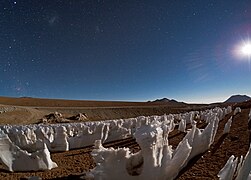 Icy Penitentes by moonlight
 -
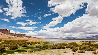 Tara Cathedrals (left) and Tara salt flat
 -
 Valle de la Luna, near San Pedro de Atacama
 -
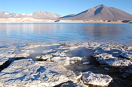
-
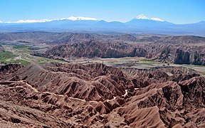 Valley in Atacama
 -
 Salt evaporation ponds in the Atacama Desert
 -
 Desert bloom (desierto florido)
 -

-
 Valley of Death
 -
 Machuca chapel
 -

-
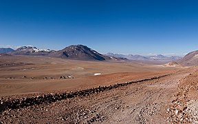
-
 The Milky Way streaking across the skies above the Chilean Atacama Desert


.jpg)

Protected areas
Legends
See also
- 2010 Copiapó mining accident
- Atacama Desert border dispute
- Camanchaca
- List of deserts by area
- Lomas
- Llano de Chajnantor Observatory
- Mano del Desierto
- Norte Grande
- Paposo
- Pulperia
- Puna de Atacama
- Salar de Atacama
- Transverse Valleys
- The asteroid 18725 Atacama has been named after the Atacama Desert.
Notes
- ^ Reforestation efforts begun in 1963 and reforestated areas are protected since 1987 in the Pampa del Tamarugal National Reserve.[31]
References
- ^ Eric Dinerstein, David Olson, et al. (2017). An Ecoregion-Based Approach to Protecting Half the Terrestrial Realm, BioScience, Volume 67, Issue 6, June 2017, Pages 534–545; Supplemental material 2 table S1b. [1]
- ^ a b Wright, John W., ed. (2006). The New York Times Almanac (2007 ed.). New York: Penguin Books. pp. 456. ISBN 978-0-14-303820-7.
- ^ Rundel, P.W.; Villagra, P.E.; et al. (2007). "Arid and Semi-Arid Ecosystems". In Veblen, Thomas T.; Young, Kenneth R.; Orme, Anthony R. (eds.). Physical Geography of South America. Oxford University Press. pp. 158–183.
- ^ Clow GD, McKay CP, Simmons Jr GM, Wharton Jr RA (1988). "Climatological observations and predicted sublimation rates at Lake Hoare, Antarctica". Journal of Climate. 1 (7): 715–728. Bibcode:1988JCli....1..715C. doi:10.1175/1520-0442(1988)001<0715:COAPSR>2.0.CO;2. PMID 11538066.
- ^ Doran PT, McKay CP, Clow GD, Dana GL, Fountain AG, Nylen T, Lyons WB (2002). "Valley floor climate observations from the McMurdo Dry Valleys". Journal of Geophysical Research: Atmospheres. 107 (D24): ACL–13.
- ^ Porazinska DL, Fountain AG, Nylen TH, Tranter M, Virginia RA, Wall DH (2004). "The biodiversity and biogeochemistry of cryoconite holes from McMurdo Dry Valley glaciers, Antarctica". Arctic, Antarctic, and Alpine Research. 36 (1): 84–91. doi:10.1657/1523-0430(2004)036[0084:TBABOC]2.0.CO;2. ISSN 1523-0430. S2CID 35782175.
- ^ "Top 10 driest places on Earth". Our Planet. 9 November 2015.
- ^ Mckay, Christopher P. (2003). "Temperature and Moisture Conditions for Life in the Extreme Arid Region of the Atacama Desert: Four Years of Observations Including the El Niño of 1997–1998" (PDF). Astrobiology. 3 (2): 393–406. Bibcode:2003AsBio...3..393M. CiteSeerX 10.1.1.516.2293. doi:10.1089/153110703769016460. PMID 14577886.
- ^ a b Veblen, Thomas T., ed. (2007). The Physical Geography of South America. Oxford University Press. p. 160. ISBN 978-0-19-531341-3.
- ^ "Atacama desert". Terrestrial Ecoregions. World Wildlife Fund. Retrieved 11 March 2008.
- ^ Handwerk, Brian (23 October 2006). "Viking Mission May Have Missed Mars Life, Study Finds". National Geographic News. National Geographic Society. Archived from the original on 6 November 2006. Retrieved 3 April 2013.
- ^ Minard, Anne (25 June 2007). "Giant Penguins Once Roamed Peru, Fossils Show". National Geographic News. National Geographic Society. Archived from the original on 28 June 2007. Retrieved 3 April 2013.
- ^ Quezada, Jorge; Cerda, José Luis; Jensen, Arturo (2010). "Efectos de la tectónica y el clima en la configuración morfológica del relieve costero del norte de Chile". Andean Geology (in Spanish). 37 (1): 78–109. doi:10.4067/s0718-71062010000100004.
- ^ Armijo, Rolando; Lacassin, Robin; Coudurier-Curveur, Aurélie; Carrizo, Daniel (2015). "Coupled tectonic evolution of Andean orogeny and global climate". Earth-Science Reviews. 143: 1–35. Bibcode:2015ESRv..143....1A. doi:10.1016/j.earscirev.2015.01.005.
- ^ Evenstar, Laura; Mather, Anna; Stuart, Finlay; Cooper, Frances; Sparks, Steve (May 2014). "Geomorphic surfaces and supergene enrichment in Northern Chile". EGU General Assembly Conference Abstracts. Vienna: EGU General Assembly 2014, held 27 April - 2 May 2014: 11126. Bibcode:2014EGUGA..1611126E.
- ^ Strain, Daniel (6 December 2023). "Deep within an inhospitable desert, a window to the first life on Earth". University of Colorado. Archived from the original on 30 December 2023. Retrieved 30 December 2023.
- ^ "Snow Comes to the Atacama Desert". ESO. Retrieved 3 April 2013.
- ^ "Hyper-Arid Atacama Desert Hit By Snow". BBC News. 7 July 2011. Archived from the original on 8 July 2011. Retrieved 7 July 2011.
- ^ "Yungay - the driest place in the world |". www.wondermondo.com. 3 November 2010. Retrieved 6 May 2017.
- ^ Boehm, Richard G.; Armstrong, David G.; Hunkins, Francis P.; Reinhartz, Dennis; Lobrecht, Merry (2005). The World and its People (Teacher's wraparound ed.). New York: Glencoe/McGraw-Hill. p. 276. ISBN 978-0-07-860977-0.
- ^ "The desert biome". University of California Museum of Paleontology.
- ^ "Rare snow in the Atacama Desert: Image of the Day". NASA. 13 July 2011.
- ^ Vesilind, Priit J. (August 2003). "The Driest Place on Earth". National Geographic Magazine. Archived from the original on 18 December 2007. Retrieved 2 April 2013. (Excerpt)
- ^ Dunai, Tibor J.; González López, Gabriel A.; Juez-Larré, Joaquim (2005). "Oligocene–Miocene age of aridity in the Atacama Desert revealed by exposure dating of erosion-sensitive landforms". Geology. 33 (4): 321. Bibcode:2005Geo....33..321D. doi:10.1130/g21184.1. ISSN 0091-7613.
- ^ Medialdea, Alicia; May, Simon Matthias; Brill, Dominik; King, Georgina; Ritter, Benedikt; Wennrich, Volker; Bartz, Melanie; Zander, Anja; Kuiper, Klaudia; Hurtado, Santiago; Hoffmeister, Dirk; Schulte, Philipp; Gröbner, Marie; Opitz, Stephan; Brückner, Helmut; Bubenzer, Olaf (January 2020). "Identification of humid periods in the Atacama Desert through hillslope activity established by infrared stimulated luminescence (IRSL) dating". Global and Planetary Change. 185: 103086. Bibcode:2020GPC...18503086M. doi:10.1016/j.gloplacha.2019.103086. hdl:1871.1/b0bea7ff-0aa7-4901-b17a-5b5bc285768d. S2CID 214198721. Retrieved 13 November 2022.
- ^ Kirk-Lawlor, Naomi E.; Jordan, Teresa E.; Rech, Jason A.; Lehmann, Sophie B. (1 October 2013). "Late Miocene to Early Pliocene paleohydrology and landscape evolution of Northern Chile, 19° to 20° S". Palaeogeography, Palaeoclimatology, Palaeoecology. 387: 76–90. Bibcode:2013PPP...387...76K. doi:10.1016/j.palaeo.2013.07.011. Retrieved 15 November 2022.
- ^ Jonathan D. A. Clarke (2006). "Antiquity of aridity in the Chilean Atacama Desert" (PDF). Geomorphology. 73 (1–2): 101–114. Bibcode:2006Geomo..73..101C. doi:10.1016/j.geomorph.2005.06.008. Archived from the original (PDF) on 5 September 2015.
- ^ a b Veloso, José Vicencio; Böhm, Christoph; Schween, Jan H.; Löhnert, Ulrich; Crewell, Susanne (2024). "A comparative study of the atmospheric water vapor in the Atacama and Namib Desert". Global and Planetary Change. 232. doi:10.1016/j.gloplacha.2023.104320.
- ^ "Chile desert's super-dry history". BBC News. 8 December 2005. Retrieved 25 April 2010.
- ^ a b Castro Castro, Luis (1 July 2020). "El bosque de la Pampa del Tamarugal y la industria salitrera: El problema de la deforestación, los proyectos para su manejo sustentable y el debate político (Tarapacá, Peru-Chile 1829-1941)" [The Forest of Pampa del Tamarugal and the Saltpeter Industry: The Deforestation Problem, the Projects for their Sustainable Management and the Political Debate (Tarapacá, Perú-Chile 1829-1941)]. Scripta Nova (in Spanish). XXIV (641). Universitat de Barcelona.
- ^ "A trip to Mars". www.eso.org. Retrieved 2 May 2017.
- ^ azua-bustos, A. (24 December 2014). "Discovery and microbial content of the driest site of the hyperarid Atacama Desert, Chile". Environmental Microbiology Reports. 7 (3): 388–94. doi:10.1111/1758-2229.12261. PMID 25545388.
- ^ Braudel, Fernand (1992). The Perspective of the World. Berkeley, Calif.: University of California Press. p. 388. ISBN 978-0-520-08116-1.
- ^ Thompson, Andrea (5 August 2008). "Scientists Set Record Straight on Martian Salt Find". Space.com. Retrieved 6 August 2008.
- ^ Wynne, J.J.; Cabrol, N.A.; Chong Diaz, G.; Grin, G.A.; Jhabvala, M.D.; Moersch, J.E.; Titus, T.N. Earth–Mars Cave Detection Program Phase 2 – 2008 Atacama Desert Expedition (PDF) (Report). Archived from the original (PDF) on 1 September 2019. Retrieved 3 April 2013.
- ^ Achenbach, Joel (21 February 2023). "Strange DNA found in the desert offers lessons in the hunt for Mars life". The Washington Post. Retrieved 21 February 2023.
- ^ Azua-Bustos, Armando; et al. (21 February 2023). "Dark microbiome and extremely low organics in Atacama fossil delta unveil Mars life detection limits". Nature Communications. 14 (808): 808. Bibcode:2023NatCo..14..808A. doi:10.1038/s41467-023-36172-1. PMC 9944251. PMID 36810853.
- ^ Yáñez, Cecilia (18 June 2019). "A 28 años del aluvión de Antofagasta, estudio advierte riesgos en zona de La Chimba". La Tercera (in Spanish). Retrieved 18 June 2021.
- ^ Melin, Jorge (15 June 2002). "Las heridas del aluvión". El Mercurio de Antofagasta (in Spanish). Retrieved 18 June 2021.
- ^ "El aluvión de Antofagasta y la solidaridad de loinos". El Mercurio de Antofagasta (in Spanish). 18 June 2007. Archived from the original on 26 June 2021. Retrieved 18 June 2021.
- ^ "Inundación en San Pedro de Atacama deja 800 afectados y 13 turistas evacuados". El Mostrador (in Spanish). 11 February 2012. Archived from the original on 31 May 2013. Retrieved 3 December 2012.
- ^ "Tourism in San Pedro de Atacama restricted by floods". This is Chile. 15 February 2012. Archived from the original on 2 December 2013. Retrieved 3 December 2012.
- ^ a b "Atacama Desert Blooms Pink After Historic Rainfall (Photos)". LiveScience.com. 29 October 2015.
- ^ a b Erin Blakemore. "The World's Driest Desert Is in Breathtaking Bloom". Smithsonian.
- ^ Thos. Morong. (12 February 1891). "The Flora of the Desert of Atacama". Bulletin of the Torrey Botanical Club. 18 (2): 39–48. doi:10.2307/2475523. JSTOR 2475523.
- ^ Monique Bos. "Animals that live in the Atacama Desert". Paw Nation. Archived from the original on 2 January 2014. Retrieved 1 August 2013.
- ^ Claudio M. Escobar; et al. (March 2003). "Chemical Composition of Precloacal Secretions of Two Liolaemus fabiani Populations: Are They Different?". Diary of Chemical Ecology. 29 (3): 629–638. doi:10.1023/A:1022858919037. PMID 12757324. S2CID 12330002.
- ^ South America physical map
- ^ Sanz, Nuria; Arriaza, Bernardo T.; Standen, Vivien G., The Chinchorro Culture: A Comparative Perspective. The archaeology of the earliest human mummification. UNESCO Office Mexico; Universidad de Tarapacá (Chile); National Monuments Council (Chile) Paris, UNESCO, 2014
- ^ "Atacama | Desert Dwellers, Ancient Cultures & Pre-Columbian Societies | Britannica". www.britannica.com. Retrieved 6 January 2024.
- ^ "South American Indian | History, Culture & Traditions | Britannica". www.britannica.com. 30 August 2022. Retrieved 6 January 2024.
- ^ Núñez A., Lautaro; Briones M., Luis (2017). "Tráfico e interacción en el oasis de Pica y la costa arreica en el desierto tarapaqueño (norte de Chile)" [Transit and interacctions between the oasis of Pica and the coast in the Atacama Desert (northern Chile)]. Estudios Atacameños (in Spanish). 56 (56): 133–161. doi:10.4067/S0718-10432017000300006.
- ^ Holsti, K.J. (1997). The State, War, and the State of War. Cambridge University Press. p. 151. ISBN 978-0-521-57790-8.
- ^ Clayton, Lawrence A. (1984). The Bolivarian Nations. The Forum Press. p. 26. ISBN 978-0-88273-603-7.
- ^ St. John, Robert Bruce (1994). The Bolivia-Chile-Peru dispute in the Atacama Desert (Report). International Boundaries Research Unit.
- ^ a b c Lictevout, Elizabeth; Abellanosa, Carlos; Maass, Constanza; Pérez, Nicolás; Gonzalo, Yáñez; Véronique, Leonardi (2020). "Exploration, mapping and characterization of filtration galleries of the Pica Oasis, northern Chile: A contribution to the knowledge of the Pica aquifer". Andean Geology. 47 (3): 529–558. doi:10.5027/andgeoV47n3-3272.
- ^ "War of the Pacific | South American history". Encyclopedia Britannica. Retrieved 27 September 2018.
- ^ "Exploring the Atacama". yes. Archived from the original on 17 January 2013. Retrieved 3 December 2012.
- ^ Kogel, Jessica Elzea (2006). Kogel, Jessica Elzea; Trivedi, Nikhil; Barker, James; Krukowski, Stanley (eds.). Industrial Minerals & Rocks: Commodities, Markets, and Uses (7th ed.). Littleton, Colo.: Society for Mining, Metallurgy, and Exploration. p. 605. ISBN 978-0-87335-233-8.
- ^ Alarcón, Julia Shipley, Muriel (4 January 2024). "The world's fashion waste ended up in Chile's Atacama Desert". Grist. Retrieved 11 February 2024.
{{cite web}}: CS1 maint: multiple names: authors list (link) - ^ "ALMA Upgrade to Image the Event Horizons of Supermassive Black Holes". ESO Announcement. Retrieved 10 June 2014.
- ^ "Top 10 Atacama Desert Facts That Every Tourist Must Know". Retrieved 19 November 2015.
- ^ Bustos, R.; Rubio, M.; et al. (2014). "Parque Astronómico de Atacama: An Ideal Site for Millimeter, Submillimeter, and Mid-Infrared Astronomy". Publications of the Astronomical Society of the Pacific. 126 (946): 1126. arXiv:1410.2451. Bibcode:2014PASP..126.1126B. doi:10.1086/679330. S2CID 118539242.
- ^ Schilling, Govert. "An Astronomer's Paradise, Chile May Be the Best Place on Earth to Enjoy a Starry Sky". Smithsonian Magazine. Retrieved 2 November 2021.
- ^ Toll, Rosser (3 October 2011). "In Chile desert, huge telescope begins galaxy probe". AFP. Retrieved 3 October 2011.
- ^ "E-ELT Site Chosen". ESO. 26 April 2010. Retrieved 29 April 2011.
- ^ "Comprehensive characterization of astronomical sites". Retrieved 4 October 2011.
- ^ "Conference Astronomical Site Testing Data in Chile". Retrieved 4 October 2011.[permanent dead link]
- ^ James Vincent (19 June 2014). "European Extremely Large Telescope to break ground (using dynamite) live later today". The Independent.
- ^ "Ruíz-Tagle ve difícil que Chile no esté en un nuevo Dakar". La Nacion. 21 November 2012. Archived from the original on 17 November 2016. Retrieved 3 December 2012.
- ^ "Dakar Rally event 2013 to culminate in Chilean capital". yes. This is Chile. 26 March 2012. Archived from the original on 29 October 2013. Retrieved 3 December 2012.
- ^ "Atacama Crossing". yes. 4 deserts. Retrieved 3 December 2012.
- ^ Volcano Marathon Volcanomarathon.com. Retrieved 18 November 2015.
- ^ "Nueva generación de autos solares son presentados en Chile". La Nacion. 7 November 2012. Archived from the original on 17 November 2016. Retrieved 3 December 2012.
- ^ "Los autos que competirán en la súper carrera solar de Atacama". La Nacion. 8 November 2012. Archived from the original on 17 November 2016. Retrieved 3 December 2012.
- ^ "Guide to Atacama Desert". Conde Nast Traveller. Conde Nast. 11 November 2009. Archived from the original on 5 April 2013. Retrieved 3 April 2013.
- ^ Vickers, Graham (2005). 21st Century Hotel. London: Laurence King. p. 122. ISBN 978-1-85669-401-8.
- ^ Erfurt-Cooper, Patricia; Cooper, Malcolm, eds. (2010). Volcano and Geothermal Tourism: Sustainable Geo-resources for Leisure and Recreation. London: Earthscan. ISBN 978-1-84407-870-7.
- ^ Mroue, Haas; Schreck, Kristina; Luongo, Michael (2005). Frommer's Argentina & Chile (3rd ed.). Hoboken, NJ [u.a.]: Wiley. p. 308. ISBN 978-0-7645-8439-8.
Bibliography
- Braudel, Fernand (1984) [1979]. The perspective of the world. Civilization and Capitalism. Vol. 3. Berkeley, CA: University of California Press. ISBN 978-0-520-08116-1. OCLC 505033669.
- Sagaris, Lake (2000). Bone and dream: into the world's driest desert. Toronto: Alfred A. Knopf Canada. ISBN 978-0-676-97223-8. OCLC 57692400.
External links
- "Mars-like Soils in the Atacama Desert, Chile, and the Dry Limit of Microbial Life", NASA press release
- "Roving robot finds desert life", article in Nature
- Detailed article issued by the Geological Society of America on the history of aridity of the Atacama Desert
- Atacama Desert Photo Gallery, photos of many different landscapes, flora and fauna of the Atacama Desert
- TECHNICAL SPECIFICATIONS of the E-ELT (acronym for European Extremely Large Telescope)
| International | |
|---|---|
| National | |
| Other | |